
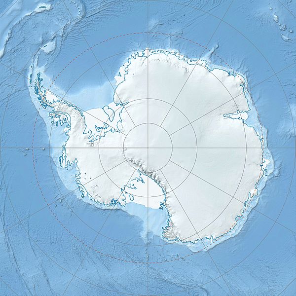
Image: Antarctica relief location map

Description: Physical Location map Antarctica, Azimuthal equidistant projection
Title: Antarctica relief location map
Credit: Own work Data from http://nsidc.org/data/moa/ - Haran, T., J. Bohlander, T. Scambos, and M. Fahnestock compilers. 2005. MODIS Mosaic of Antarctica image map. National Snow and Ice Data Center, digital media. Metadata for Antarctica's Coastline and Ice Sheet Grounding Line Files: http://nsidc.org/data/docs/agdc/nsidc0280_scambos/ ETOPO1 Ice Surface: Amante, C. and B. W. Eakins, ETOPO1 1 Arc-Minute Global Relief Model: Procedures, Data Sources and Analysis. NOAA Technical Memorandum NESDIS NGDC-24, 19 pp, March 2009.
Author: Alexrk2
Usage Terms: Creative Commons Attribution-Share Alike 3.0
License: CC BY-SA 3.0
License Link: https://creativecommons.org/licenses/by-sa/3.0
Attribution Required?: Yes
Image usage
More than 100 pages link to this image. The following list shows the first 100 page links to this image only. A full list is available.
- Aaron Glacier
- Abbot Ice Shelf
- Acosta Glacier
- Ahrnsbrak Glacier
- Anchialus Glacier
- Arapya Glacier
- Aster Glacier
- Bailey Ice Stream
- Balish Glacier
- Bearman Glacier
- Bellisime Glacier
- Bender Glacier
- Berisad Glacier
- Blaiklock Glacier
- Bolgrad Glacier
- Branscomb Glacier
- Brook Glacier
- Bulbur Glacier
- Burdenis Glacier
- Cadwalader Inlet
- Cairns Glacier
- Cape Petersen
- Carey Glacier
- Cervellati Glacier
- Chavez Glacier
- Cooke Glacier
- Cornwall Glacier (Coats Land)
- Cox Glacier
- Craddock Massif
- Craft Glacier
- Crosswell Glacier
- Dater Glacier
- Davies Escarpment
- Dawson-Lambton Glacier
- Deadmond Glacier
- Deception Island
- Della Pia Glacier
- Delyo Glacier
- Divdyadovo Glacier
- Dobbratz Glacier
- Donnellan Glacier
- Drama Glacier
- Driscoll Glacier
- Ellen Glacier
- Ellsworth Mountains
- Embree Glacier
- Evans Ice Stream
- Exum Glacier
- Fendorf Glacier
- Flanagan Glacier
- Foley Glacier
- Fonfon Glacier
- Frankenfield Glacier
- Gabare Glacier
- Galicia Peak
- Gerila Glacier
- Gildea Glacier
- Giles Glacier
- Glen Glacier
- Goff Glacier
- Goldsmith Glacier
- Goodell Glacier
- Gopher Glacier
- Gordon Glacier
- Gowan Glacier
- Grimes Glacier
- Guerrero Glacier
- Hale Glacier
- Hansen Glacier
- Haskell Glacier
- Havola Escarpment
- Hayes Glacier
- Henderson Glacier
- Henry Inlet
- Heritage Range
- Hinkley Glacier
- Hlubeck Glacier
- Hough Glacier
- Hudman Glacier
- Hudson Mountains
- Hyde Glacier
- Isbrecht Glacier
- Jeffries Glacier
- Jones Mountains
- Kannheiser Glacier
- Karasura Glacier
- King Edward Cove
- Koether Inlet
- Kopsis Glacier
- Kornicker Glacier
- Lardeya Ice Piedmont
- Lazuren Bryag Cove
- Lerchenfeld Glacier
- Levko Glacier
- Litz Glacier
- Long Glacier
- Lucchitta Glacier
- Mawson's Huts
- Mawson Station
- Mount Erebus
