
Image: AquaMap Diver LBL Acoustic Positioning Equipment
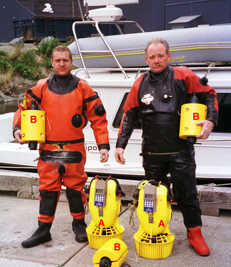
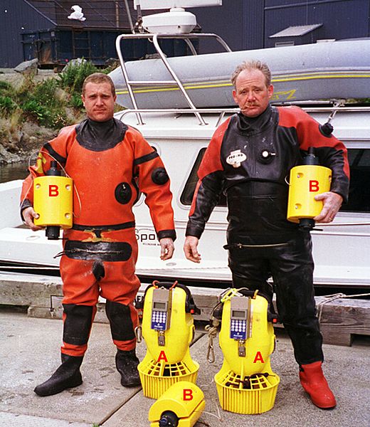
Description: Dive team (Envirotech Divers) with an AquaMap long-baseline (LBL) acoustic positioning system. The three baseline transponders (B) are deployed prior to a dive and serve as the reference points for navigation. Using a short (2m) anchor line and a weight, they are secured to the seafloor. If repeat surveys need to be done over a period of time to monitor changes, the preferred technique is to establish a 'monument' at each baseline station location and secure the baseline station to that monument each time to minimize positioning variability. A monument may be a block of concrete, a railroad wheel or another heavy object. It may also be a distinctive natural feature such as a boulder. The divers navigate and record position using a terminal (A) similar to a GPS receiver. The terminal receives positioning data (baseline station distance and depth measurements) either from an integrated acoustic transponder, such as in the DS-1 station shown here, or from an external transponder.
Title: AquaMap Diver LBL Acoustic Positioning Equipment
Credit: Own work
Author: Desertstar
Permission: Desert Star permission
Usage Terms: Creative Commons Attribution 3.0
License: CC BY 3.0
License Link: http://creativecommons.org/licenses/by/3.0
Attribution Required?: Yes
Image usage
The following page links to this image:
