
Image: Arkansas Post Battlefield Arkansas
Size of this preview: 457 × 600 pixels. Other resolutions: 183 × 240 pixels | 1,410 × 1,850 pixels.
Original image (1,410 × 1,850 pixels, file size: 713 KB, MIME type: image/jpeg)
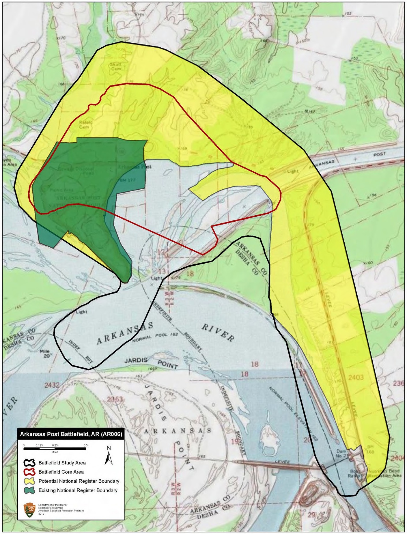
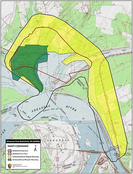
Description: Map of battlefield core and study areas. The 1993 Study Area included lands associated with the Federal flotilla’s movements toward Notrebes Landing prior to January 9. That land was excised, reducing the Study Area to only land associated with the events of January 9-11, 1863. The Study Area was further revised to reflect the historic bend in the Arkansas River.
The ABPP reduced the Core Area to identify more accurately the area of the land engagement, the location of the gunboat assault, and the placement of the Federal batteries built across the Arkansas River from Fort Hindman.
Usage Terms: Public domain
Image usage
The following 2 pages link to this image:

All content from Kiddle encyclopedia articles (including the article images and facts) can be freely used under Attribution-ShareAlike license, unless stated otherwise.