
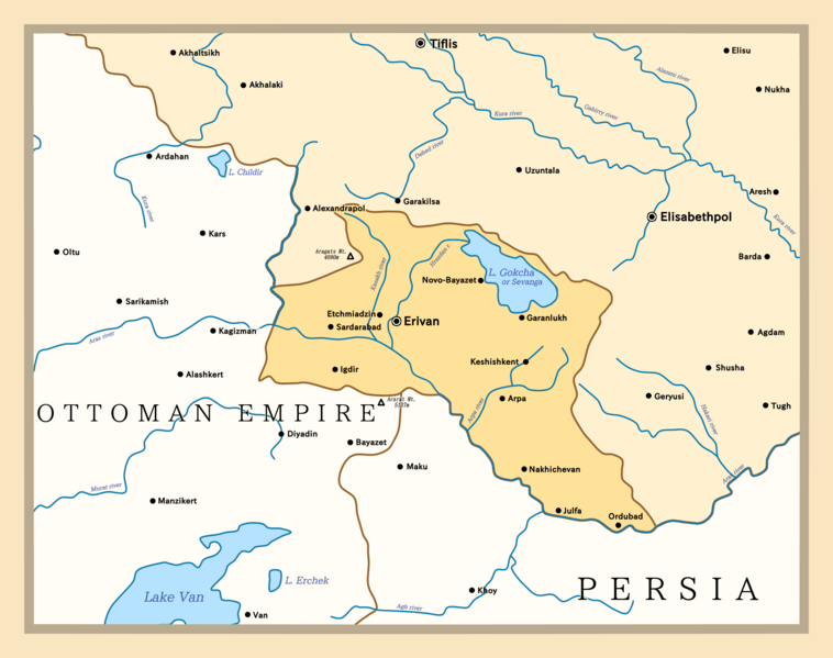
Image: Armenian Oblast, 1828-1840

Size of this preview: 758 × 599 pixels. Other resolutions: 304 × 240 pixels | 2,088 × 1,651 pixels.
Original image (2,088 × 1,651 pixels, file size: 142 KB, MIME type: image/png)
Description: Map of the Armenia Oblast within the Russian Empire from its establishment in 1828 to abolishment in 1840. Map shows cities with names used in the period of the oblast's existence.
Title: Armenian Oblast, 1828-1840
Credit: This PNG graphic was created with Medibang.
Author: Golden
Usage Terms: Creative Commons Attribution-Share Alike 4.0
License: CC BY-SA 4.0
License Link: https://creativecommons.org/licenses/by-sa/4.0
Attribution Required?: Yes
Image usage
The following page links to this image:

All content from Kiddle encyclopedia articles (including the article images and facts) can be freely used under Attribution-ShareAlike license, unless stated otherwise.