
Image: Armenian distribution map
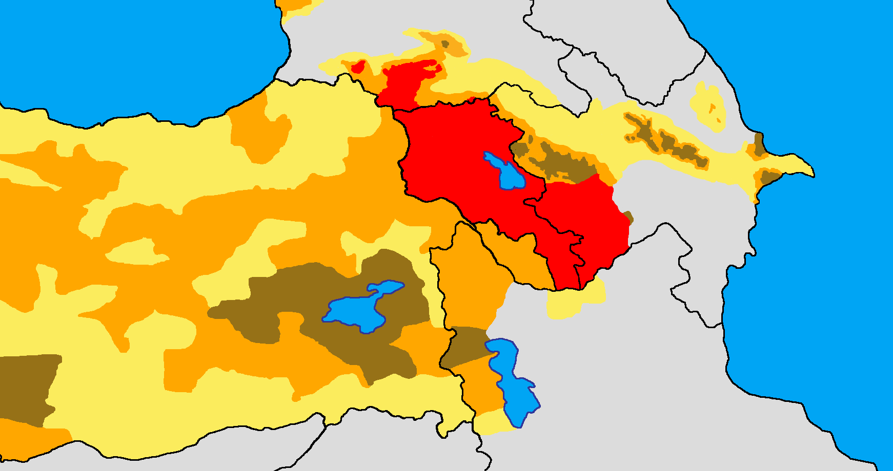
Description: Historical and modern distribution of Armenians. Settlement areas of Armenians in early 21st century. Settlement areas of Armenians in early 20th century. More than 50% 25-50% Less than 25% Works used: (in Armenian) Yerevan State University Institute for Armenian Studies: Արևմտահայությունը XIXդ. 70-ական թթ. (էթնիկ քարտեզ) (Western Armenians in 1870s (ethnic map)) (in Russian) А. Цуциев (A. Tsutseyev), Атлас Этнополитической Истории Кавказа (Atlas of the Ethno-political history of the Caucasus), "Yevropa" Publishing House, Moscow, 2007: 1886–1890: Этнолингвистическая карта Кавказа (1886-1890: Ethno-linguistic map of the Caucasus) European Centre for Minority Issues, Ethnic Map of Georgia; January 2009 (in Russian) Армяне накануне геноцида. Нач. XX века. (Armenians on the eve of genocide. Early 20th century.) (in Russian) Карапетян Сергей Арменакович Арцах, Гардман, Нахиджеван - триединая формула территориальной целостности Восточной Армении Ереван 2008.
Title: Armenian distribution map
Credit: Own work
Author: Yerevanci
Usage Terms: Creative Commons Attribution-Share Alike 3.0
License: CC BY-SA 3.0
License Link: https://creativecommons.org/licenses/by-sa/3.0
Attribution Required?: Yes
Image usage
