
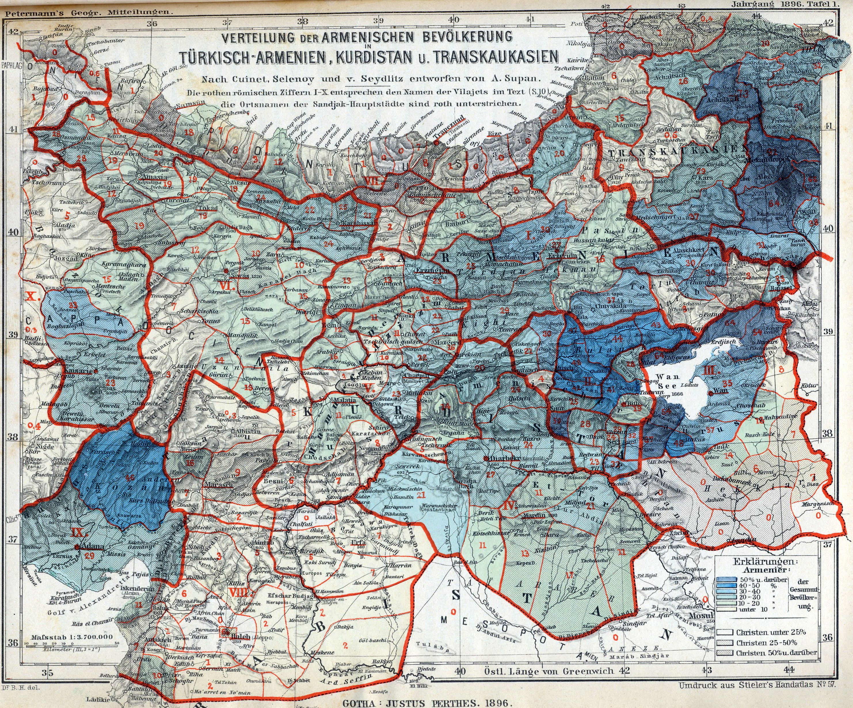
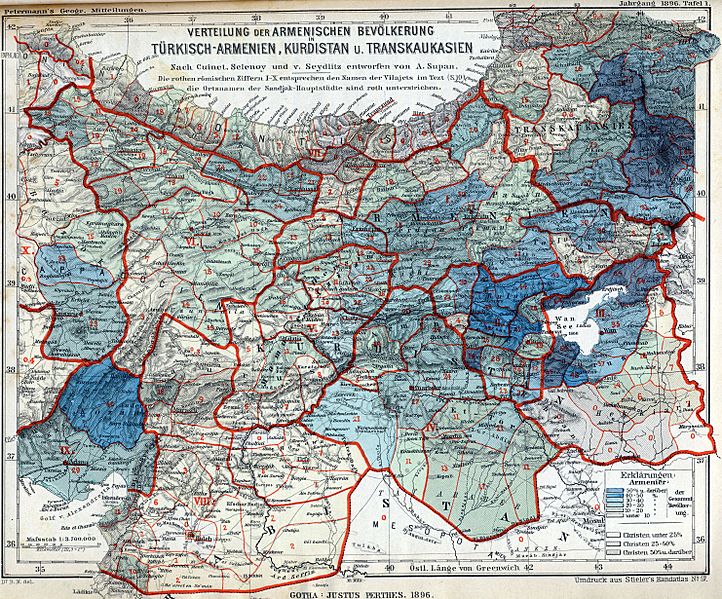
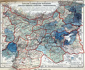
Image: Armenian population map 1896
Size of this preview: 722 × 599 pixels. Other resolutions: 289 × 240 pixels | 2,964 × 2,460 pixels.
Original image (2,964 × 2,460 pixels, file size: 2.88 MB, MIME type: image/jpeg)
Description: The Armenian population in historical Armenian regions in 1896. The Armenian population is represented in the colored areas, as well as in the red Arabic numbers, indicating their exact percentage.
Title: Armenian population map 1896
Credit: Petermanns Geographische Mitteilungen
Author: own scan
Usage Terms: Public domain
License: Public domain
Attribution Required?: No
Image usage
The following 3 pages link to this image:

All content from Kiddle encyclopedia articles (including the article images and facts) can be freely used under Attribution-ShareAlike license, unless stated otherwise.