
Image: ArnoldExpeditionRouteMarked
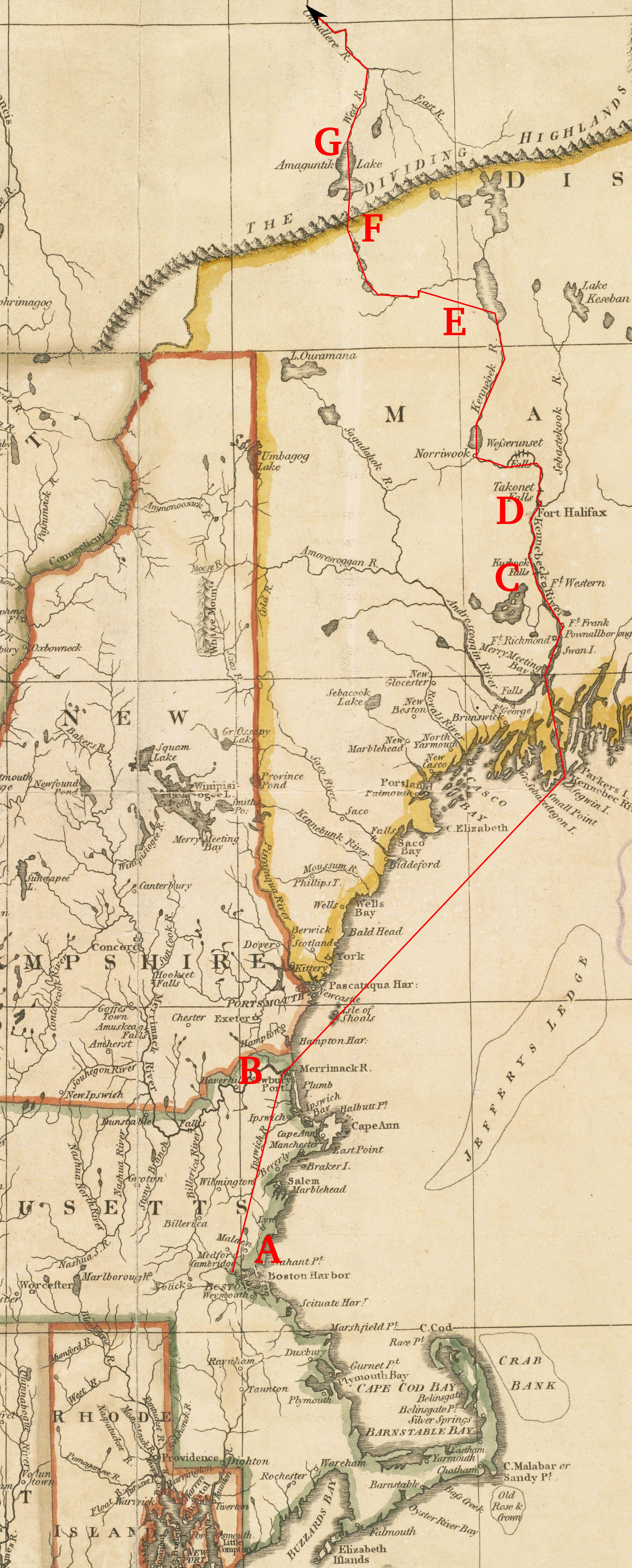
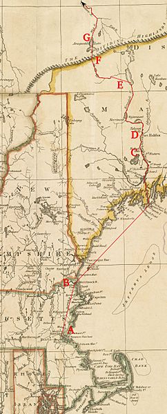
Description: This is a detail from a 1795 map depicting the New England states. It is marked with the route of Benedict Arnold's expedition to Quebec City in September 1775. Legend: A: Cambridge, Massachusetts B: Newburyport, Massachusetts C: Fort Western D: Fort Halifax E: Lower end of the Great Carrying Place F: height of land between the Kennebec and the Chaudière River drainages G: Lake Mégantic This map does not accurately represent the area around the height of land and Lake Mégantic, so the actual route is only approximate.
Title: ArnoldExpeditionRouteMarked
Credit: Source map from the Boston Public Library Map Collection
Author: John Russell (underlying map), User:Magicpiano (markings)
Usage Terms: Public domain
License: Public domain
Attribution Required?: No
Image usage
