
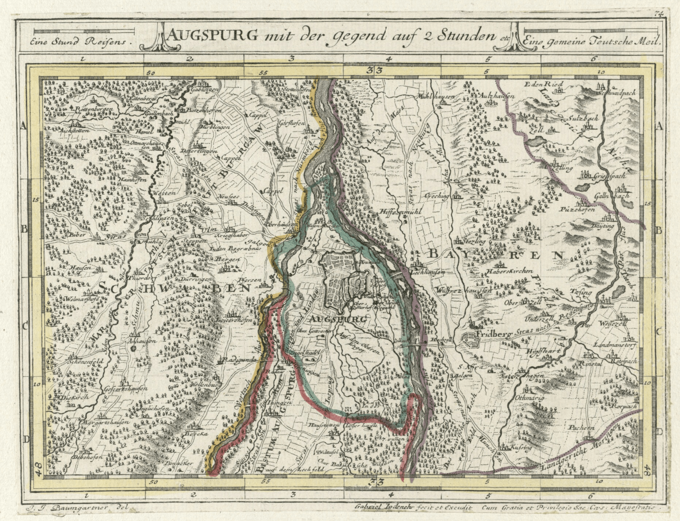
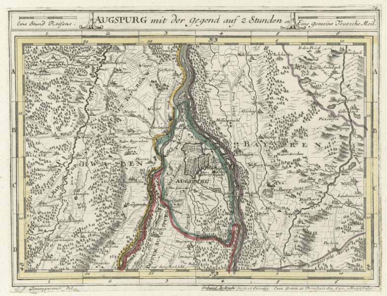
Image: Augsburg map 1705-1720
Size of this preview: 782 × 599 pixels. Other resolutions: 313 × 240 pixels | 2,236 × 1,714 pixels.
Original image (2,236 × 1,714 pixels, file size: 6.33 MB, MIME type: image/png)
Description: Early 18th century map of Augsburg and surrounding area. The blue line delineates the territory of the Free Imperial City of Augsburg, which included the city proper and a small surrounding area. Augsburg was separate and independent from the Prince-Bishopric of Augsburg.
Title: Augsburg map 1705-1720
Credit: Moll's map collection
Author: J. J. Baumgartner; Gabriel Bodenehr
Usage Terms: Public domain
License: Public domain
Attribution Required?: No
Image usage
The following page links to this image:

All content from Kiddle encyclopedia articles (including the article images and facts) can be freely used under Attribution-ShareAlike license, unless stated otherwise.