
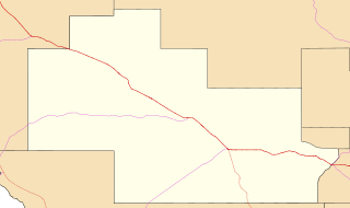
Image: Australia South Australia Wudinna District Council location map

Size of this PNG preview of this SVG file: 800 × 474 pixels. Other resolution: 320 × 190 pixels.
Original image (SVG file, nominally 1,027 × 609 pixels, file size: 2.54 MB)
Description: Created by using QGIS from data sourced from http://data.sa.gov.au under CC-BY licence Locator map for Wudinna District Council. Map extents are 134.719, -33.350, 136.003, -32.589
Title: Australia South Australia Wudinna District Council location map
Credit: Transferred from en.wikipedia to Commons.
Author: The original uploader was ScottDavis at English Wikipedia.
Usage Terms: Creative Commons Attribution 3.0
License: CC BY 3.0
License Link: https://creativecommons.org/licenses/by/3.0
Attribution Required?: Yes
Image usage
The following page links to this image:

All content from Kiddle encyclopedia articles (including the article images and facts) can be freely used under Attribution-ShareAlike license, unless stated otherwise.