
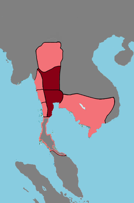
Image: Ayutthaya Map in 1605
Description: Ayutthaya's sphere of influence under King Naresuan, 1605. Dark red represents areas directly controlled by Ayutthaya (or the geographic region of Siam as coined by Baker/Phongpaichit in "A History of Ayutthaya: Siam in the Early Modern World". Light pink represents areas which swore fealty following Ayutthaya military expeditions. Highlighted light pink represents largely independent tributaries (areas very nominally under Ayutthaya's sphere of influence during the 16th century (in comparison to the 15th and later in the 17th and 18th centuries). Highlighted dark grey represents Chiang Saen, which was never under Ayutthaya's control. Drawn this map by using Photoshop (and later Paint). Later Paint.net.
Title: Ayutthaya Map in 1605
Credit: Own work, with assistance from these sources: [1][2][3][4]
Author: Xailang, Yourlocallordandsavior
Usage Terms: Creative Commons Zero, Public Domain Dedication
License: CC0
License Link: http://creativecommons.org/publicdomain/zero/1.0/deed.en
Attribution Required?: No
Image usage
The following page links to this image:
