
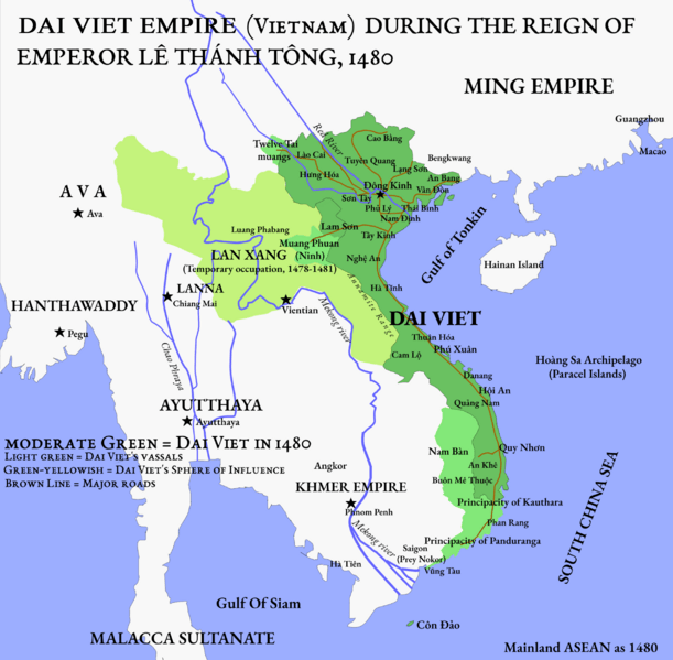
Image: Bản đồ Việt Nam dưới thời vua Lê Thánh Tông, vương triều Lê Sơ năm 1480

Size of this preview: 611 × 599 pixels. Other resolutions: 245 × 240 pixels | 2,549 × 2,500 pixels.
Original image (2,549 × 2,500 pixels, file size: 1.09 MB, MIME type: image/png)
Description: Map of Vietnam during the zenith of Lê dynasty, c. 1480.
Title: Bản đồ Việt Nam dưới thời vua Lê Thánh Tông, vương triều Lê Sơ năm 1480
Credit: Own work. Source cited from Ben Kiernan (2017), Việt Nam: A History from Earliest Times to the Present. Oxford University Press.
Author: Hữu Nhật
Usage Terms: Creative Commons Zero, Public Domain Dedication
License: CC0
License Link: http://creativecommons.org/publicdomain/zero/1.0/deed.en
Attribution Required?: No
Image usage
The following 2 pages link to this image:

All content from Kiddle encyclopedia articles (including the article images and facts) can be freely used under Attribution-ShareAlike license, unless stated otherwise.