
Image: Balawaristan
Size of this preview: 800 × 477 pixels. Other resolutions: 320 × 191 pixels | 990 × 590 pixels.
Original image (990 × 590 pixels, file size: 70 KB, MIME type: image/jpeg)
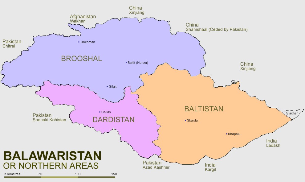
Description: A map of Balawaristan, with its three constituent regions (Brooshal, Dardistan and Baltistan), as well as the region of Siachen Glacier (currently administered by India).
Title: Balawaristan
Credit: Northern_Areas_Pakistan.svg
Author: Northern_Areas_Pakistan.svg: Pahari Sahib derivative work: Zarwana (talk)
Usage Terms: Creative Commons Attribution-Share Alike 3.0
License: CC-BY-SA-3.0
License Link: http://creativecommons.org/licenses/by-sa/3.0/
Attribution Required?: Yes
Image usage
The following 2 pages link to this image:

All content from Kiddle encyclopedia articles (including the article images and facts) can be freely used under Attribution-ShareAlike license, unless stated otherwise.