
Image: Balkans925

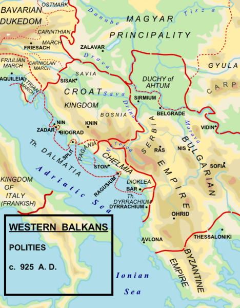
Description: Political map of the western Balkan in 925 AD.
Title: Balkans925
Credit: Made by Hxseek using the following sources: Map from: en:File:Roman Empire 125.svg by Andrei nacu Info from: (1) The Early Medieval Balkans. A Critical Survey from the Sixth to the Late Twelfth Century. J V A Fine, Jr. Pg 262: To the south of the Drava, he (King Tomislav)held what we think of modern Croatia, Slavonia, northern and western Bosnia, and the territory along the Dalmatian coast to the mouth of the Cetina river (excluding scattered Byzantine towns) (2) The Balkans. From Constantinople to Communism. D P Hupchik. Map 3, depicts Croatia to extend approximately to the Drina river. (3) Shepherds Historical Atlas.
Author: Hxseek at English Wikipedia
Permission: Public domainPublic domainfalsefalse This work has been released into the public domain by its author, Hxseek. This applies worldwide. In some countries this may not be legally possible; if so: Hxseek grants anyone the right to use this work for any purpose, without any conditions, unless such conditions are required by law.
Usage Terms: Public domain
License: Public domain
Attribution Required?: No
Image usage
The following page links to this image:
