
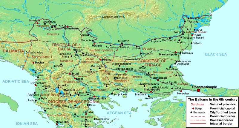
Image: Balkans 6th century

Description: Map of the northern Balkans in the 6th century AD, with the Roman provinces, major settlements and roads.
Title: Balkans 6th century
Credit: Own work based on: Geophysical map taken from DEMIS Mapserver, which are public domain, other wise self-made. Map of the cities listed in Hierocles' Synecdemus after Ernest Honigmann, Le Synecdèmos d'Hiéroclès et l'opuscule géographique de Georges de Chypre, Brussels 1939 Florin Curta, The Making of the Slavs - History and Archaeology of the Lower Danube Region, c. 500–700, Cambridge University Press 2001, ISBN 978-0521802024 John F. Haldon, Warfare, state and society in the Byzantine world, 565–1204 Routledge 1999, ISBN 978-1857284959.
Author: Cplakidas
Usage Terms: Creative Commons Attribution-Share Alike 3.0
License: CC BY-SA 3.0
License Link: https://creativecommons.org/licenses/by-sa/3.0
Attribution Required?: Yes
Image usage
The following page links to this image:
