
Image: BalticGovernorates1914
Size of this preview: 606 × 600 pixels. Other resolutions: 243 × 240 pixels | 3,012 × 2,980 pixels.
Original image (3,012 × 2,980 pixels, file size: 925 KB, MIME type: image/png)
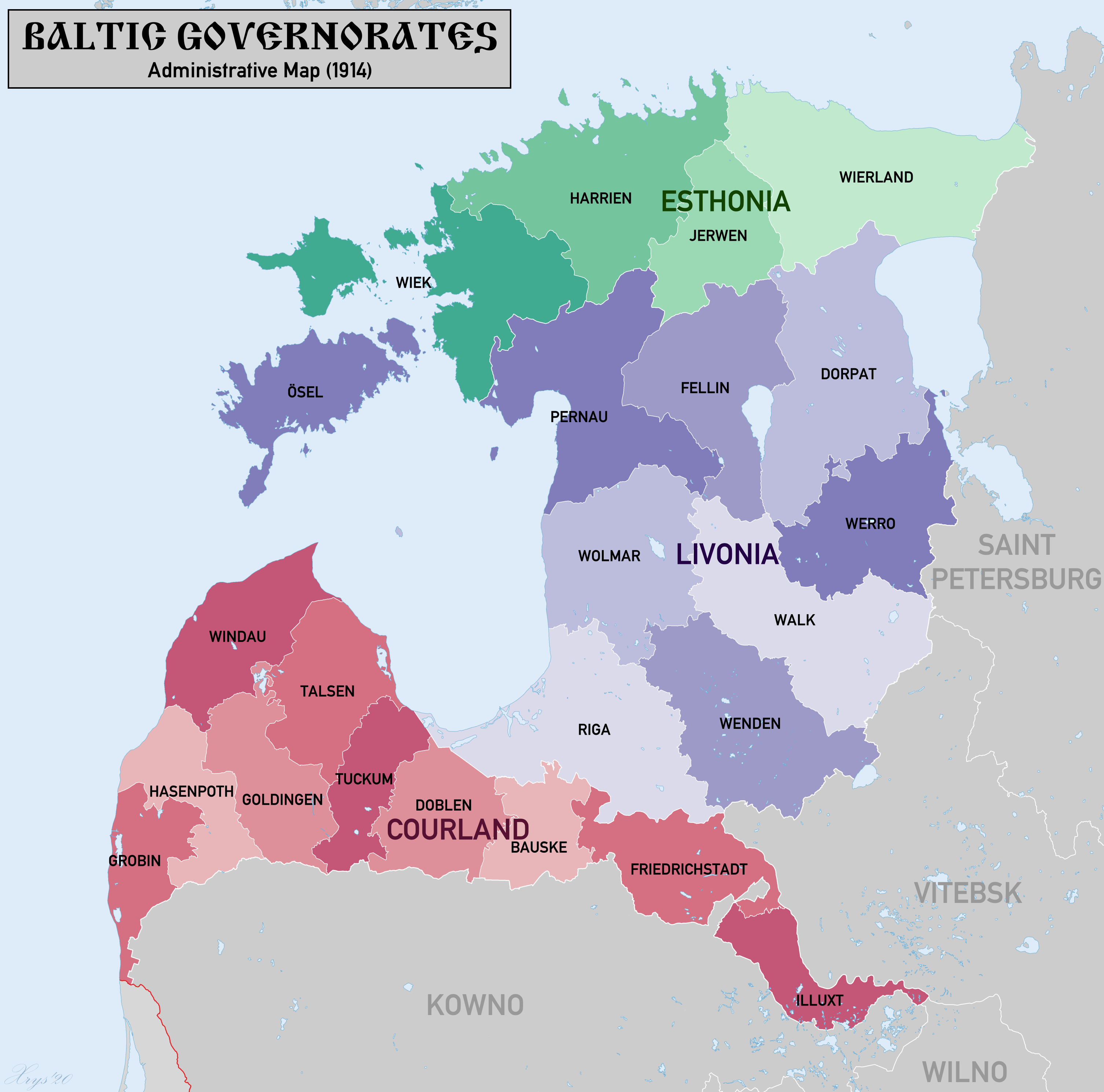
Description: Map of the Baltic Governorates of the Russian Empire in 1914. Showing the Governorates and Districts of Esthonia, Livonia and Courland. Source Map Data: Специальная карта европейской России (1:420k), Ubersichtskarte von Mitteleuropa (1:300k), courtesy of www.mapywig.com
Title: BalticGovernorates1914
Credit: Own work
Author: XrysD
Usage Terms: Creative Commons Attribution-Share Alike 4.0
License: CC BY-SA 4.0
License Link: https://creativecommons.org/licenses/by-sa/4.0
Attribution Required?: Yes
Image usage
There are no pages that link to this image.

All content from Kiddle encyclopedia articles (including the article images and facts) can be freely used under Attribution-ShareAlike license, unless stated otherwise.