
Image: Bass Strait infrastructure
No higher resolution available.
Bass_Strait_infrastructure.png (500 × 467 pixels, file size: 191 KB, MIME type: image/png)
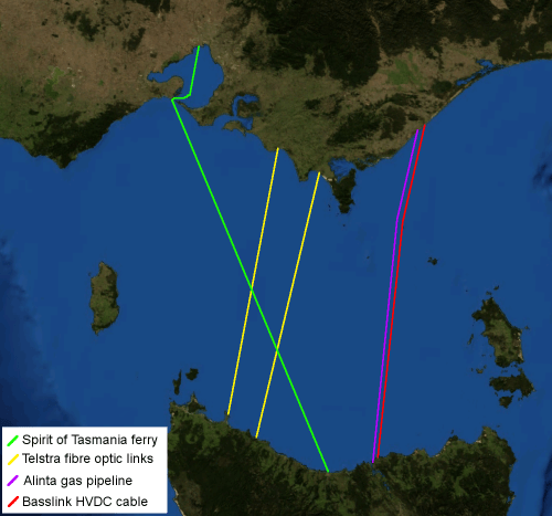
Description: Map of Bass Strait including electrical, gas, communications and transport infrastructure. Background imagery derived from NASA World Wind.
Title: Bass Strait infrastructure
Credit: Transferred from en.wikipedia to Commons by Yuval Y using CommonsHelper.
Author: Chuq at English Wikipedia
Usage Terms: Public domain
License: Public domain
Attribution Required?: No
Image usage
The following page links to this image:

All content from Kiddle encyclopedia articles (including the article images and facts) can be freely used under Attribution-ShareAlike license, unless stated otherwise.