
Image: BattleOfFortWashingtonMapBySauthier
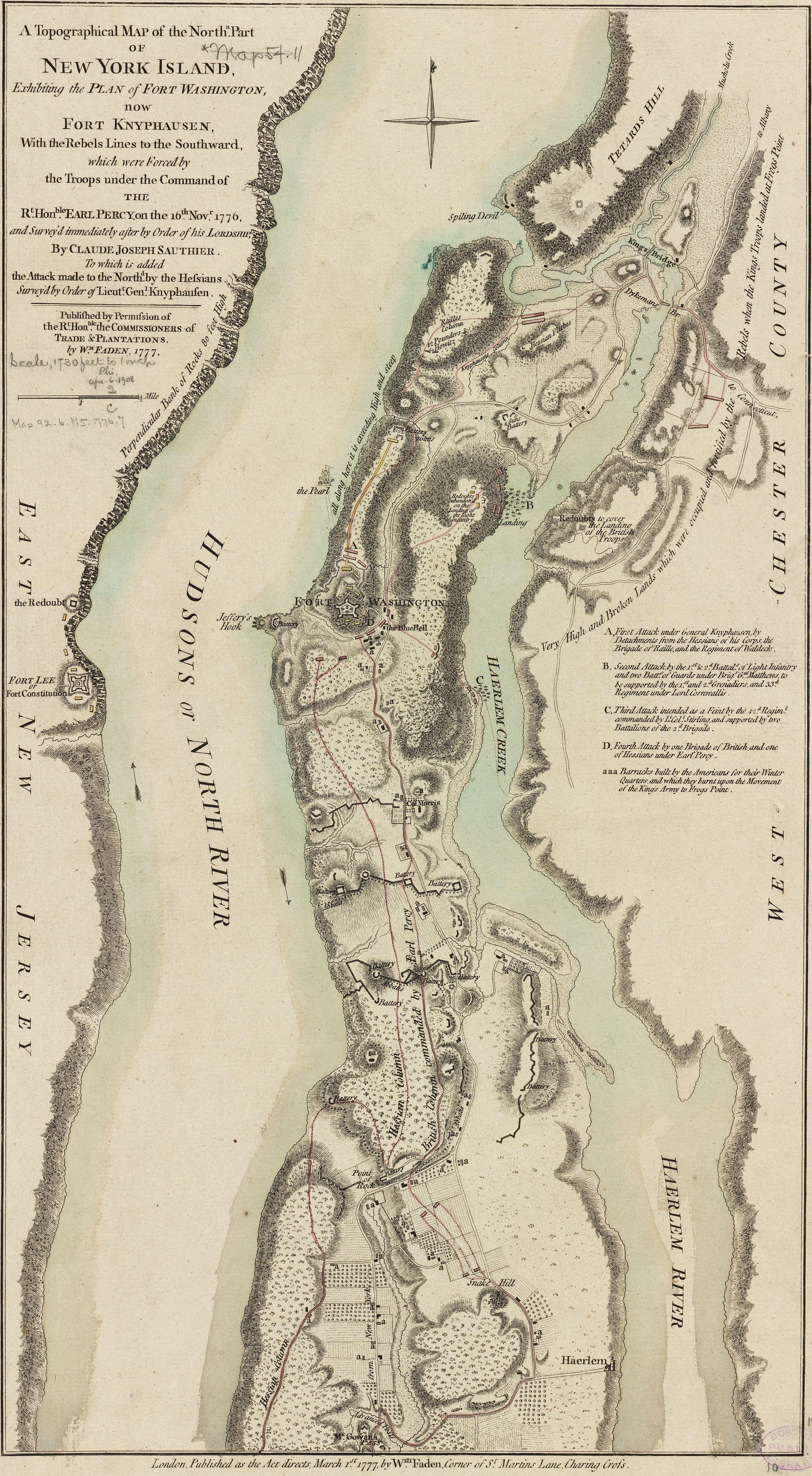
Description: This map depicts the northern end of Manhattan, and the military fortifications in the area in 1776, during the American Revolutionary War. It has markings describing the military movements of the Battle of Fort Washington, fought November 16, 1776. The map's caption reads: A Topographical Map of the Northn. Part of New York Island, Exhibiting the Plan of Fort Washington, now Fort Knyphausen, With the Rebels Lines to the Southward, which were forced by the Troops under the Command of the Rt. Honble. Earl Percy, on the 16th Novr. 1776, and Survey'd immediately after by Order of his Lordship, By Claude Joseph Sauthier. To which is added the Attack made to the Northd. by the Hessians Survey'd by Order of Lieutt. Genl. Knyphausen. Published by Permission of The Rt. Honble. the Commissioners of Trade & Plantations. By Wm. Faden, 1777.
Title: BattleOfFortWashingtonMapBySauthier
Credit: From the Boston Public Library Digital Map Collection: http://maps.bpl.org/details_10863/ Call number: G3804.N4S3 1777 .S2
Author: Claude Joseph Sauthier
Usage Terms: Public domain
License: Public domain
Attribution Required?: No
Image usage
The following page links to this image:
