
Image: Battle of Mount Sorrel - Battle Map - June 6 (restored1)
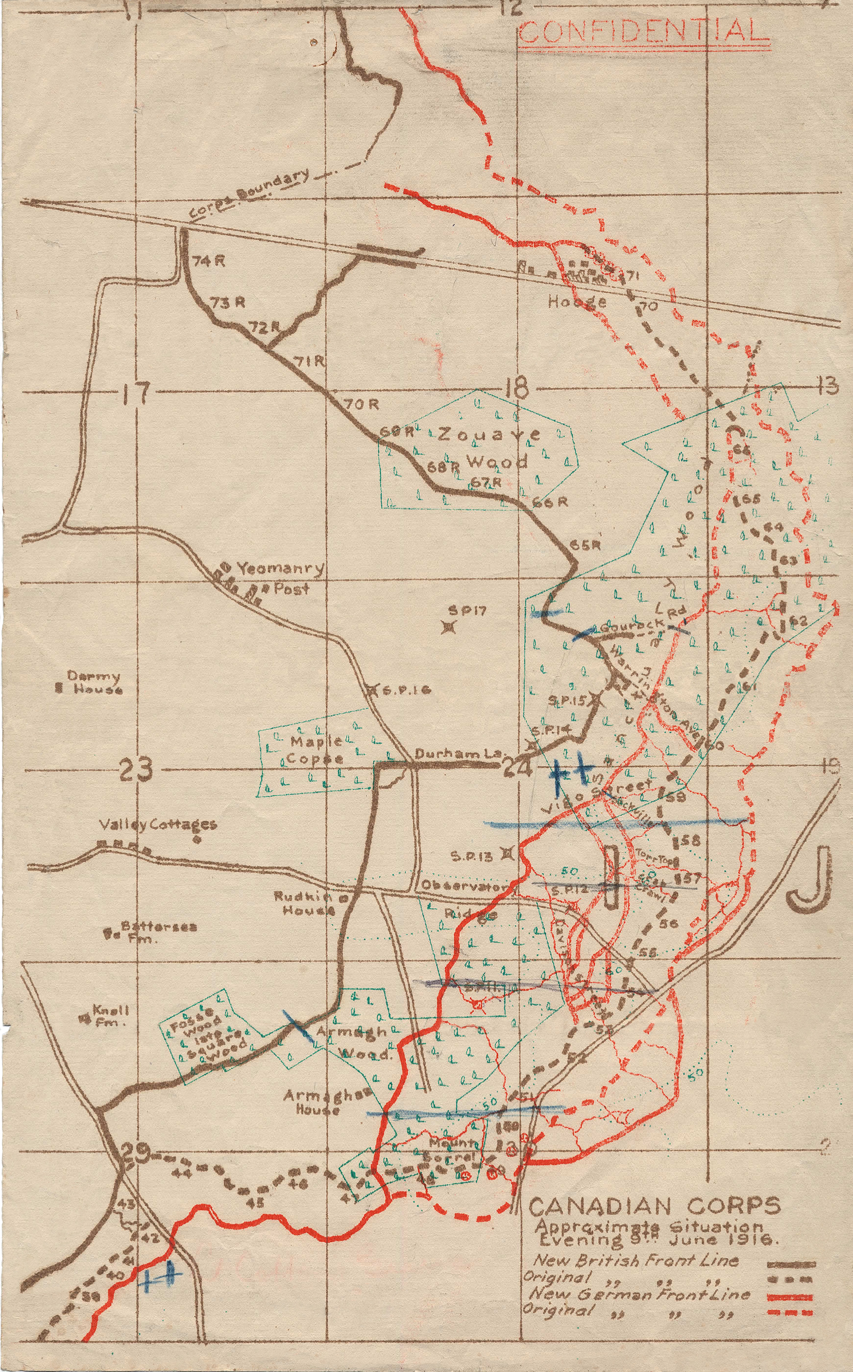
Description: This map illustrates the British/Canadian positions (in brown) and the German lines (in red) on 4 June 1916, during the Battle of Mount Sorrel. The Canadians have been driven from several strong points, including Hooge north), Mount Sorrel itself (south), and most of Observatory Ridge (centre).
Title: Battle of Mount Sorrel - Battle Map - June 6 (restored1)
Credit: George Metcalf Archival Collection, Canadian War Museum: 19870027-018 [1]
Author: n.d.
Permission: This Canadian work is in the public domain in Canada because its copyright has expired due to one of the following: 1. it was subject to Crown copyright and was first published more than 50 years ago, orit was not subject to Crown copyright, and 2. it is a photograph that was created prior to January 1, 1949, or 3. the creator died prior to January 1, 1972.
Usage Terms: Public domain
License: Public domain
Attribution Required?: No
Image usage
The following page links to this image:

.jpg)