
Image: Battle of whitemarsh view
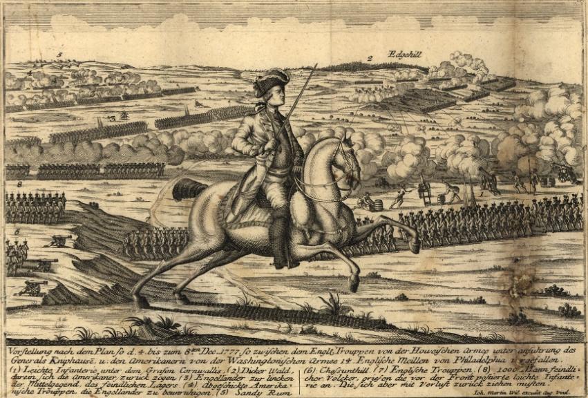
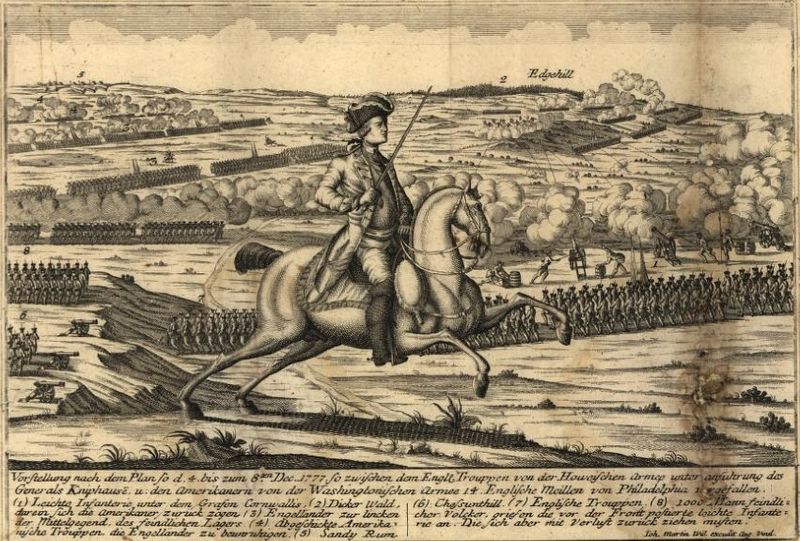
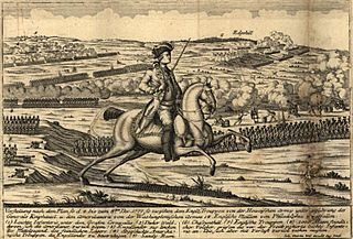
Description: View from the British positions at the en:Battle of White Marsh. Chestnut Hill is in the lower left of the image, Sandy Run in the upper left, and Edge Hill in the upper right. Vorstellung nach dem Plan so d. 4. bis zum 8ten Dec. 1777 so zwischen dem Engl. Trouppen von der Howeischen Armee unter Anführung des Generals Kniphausē u. den Amerikanern von der Washingtonischen Armee 14 englische Meilen von Philadelphia vergefallen...
Title: Battle of whitemarsh view
Credit: Library of Congress, Geography and Map Division. <http://hdl.loc.gov/loc.gmd/g3821sm.gas00001> (via en.wikipedia; description page is/was here).
Author: By Johann Martin Will. Map. Augsburg, Germany: ?, 1777
Usage Terms: Public domain
License: Public domain
Attribution Required?: No
Image usage
The following 4 pages link to this image:
