
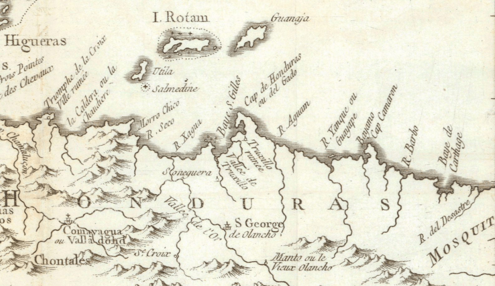
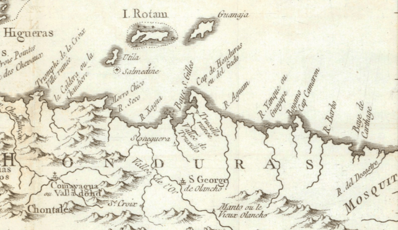
Image: Bay Islands and coast of Honduras 1754
Size of this preview: 800 × 463 pixels. Other resolutions: 320 × 185 pixels | 1,587 × 918 pixels.
Original image (1,587 × 918 pixels, file size: 1.09 MB, MIME type: image/png)
Description: The Bay Islands and Atlantic coast of Honduras. Cropped from a Nicolas Bellin map titled Carte Des Provinces De Verapaz, Guatimala, Honduras Et Yucatan. Published in 1754.
Title: Bay Islands and coast of Honduras 1754
Credit: Online antique map retailer
Author: Jacques Nicolas Bellin, c. 1754
Usage Terms: Public domain
License: Public domain
Attribution Required?: No
Image usage
The following page links to this image:

All content from Kiddle encyclopedia articles (including the article images and facts) can be freely used under Attribution-ShareAlike license, unless stated otherwise.