
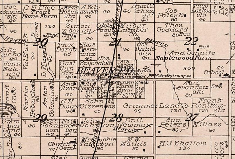
Image: Beaver WI 1912

Size of this preview: 800 × 541 pixels. Other resolutions: 320 × 217 pixels | 1,866 × 1,263 pixels.
Original image (1,866 × 1,263 pixels, file size: 616 KB, MIME type: image/jpeg)
Description: Map detail of Beaver, Wisconsin. From Standard Atlas of Marinette County Wisconsin Including a Plat Book of the Villages, Cities and Townships of the County. 1912. Chicago: Geo. A. Ogle & Co.
Title: Beaver WI 1912
Credit: Standard Atlas of Marinette County Wisconsin Including a Plat Book of the Villages, Cities and Townships of the County. 1912. Chicago: Geo. A. Ogle & Co.
Author: Geo. A. Ogle & Co.
Usage Terms: Public domain
License: Public domain
Attribution Required?: No
Image usage
The following page links to this image:

All content from Kiddle encyclopedia articles (including the article images and facts) can be freely used under Attribution-ShareAlike license, unless stated otherwise.