
Image: Bedfordshire UK location map

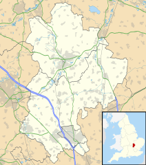
Description: Map of Bedfordshire, UK with the following information shown: Administrative borders Coastline, lakes and rivers Motorways, primary routes and railways Urban areas Equirectangular map projection on WGS 84 datum, with N/S stretched 160% Geographic limits: West: 0.8W East: 0.05W North: 52.33N South: 51.8N
Title: Bedfordshire UK location map
Credit: Ordnance Survey OpenData. Administrative borders and coastline data from Boundary-Line product. All other geographic data from Meridian 2 product. Inset derived from England location map.svg by Spischot.
Author: Nilfanion, created using Ordnance Survey data
Permission: This file is licensed under the Creative Commons Attribution-Share Alike 3.0 Unported license. Attribution: Contains Ordnance Survey data © Crown copyright and database right You are free: to share – to copy, distribute and transmit the work to remix – to adapt the work Under the following conditions: attribution – You must attribute the work in the manner specified by the author or licensor (but not in any way that suggests that they endorse you or your use of the work). share alike – If you alter, transform, or build upon this work, you may distribute the resulting work only under the same or similar license to this one. http://creativecommons.org/licenses/by-sa/3.0 CC BY-SA 3.0 Creative Commons Attribution-Share Alike 3.0 truetrue
Usage Terms: Creative Commons Attribution-Share Alike 3.0
License: CC BY-SA 3.0
License Link: http://creativecommons.org/licenses/by-sa/3.0
Attribution Required?: Yes
Image usage
The following 51 pages link to this image:
- Ampthill
- Arlesey
- Barton-le-Clay
- Bedford
- Bedford Castle
- Biggleswade
- Biggleswade Castle
- Bletsoe Castle
- Bushmead Priory
- Cainhoe Castle
- Chalgrave Castle
- Church of All Saints, Sutton, Bedfordshire
- Dunstable
- Eastcotts Castle
- Etonbury Castle
- Flitwick
- Flitwick Castle
- Forest of Marston Vale
- Gannocks Castle
- Great Barford Castle
- Higham Gobion Castle
- Houghton Regis
- Kempston
- Leighton Buzzard
- Linslade
- Luton
- MOD Chicksands
- Maiden Bower hillfort
- Odell Castle
- Old Warden Castle
- Podington Castle
- Potton
- RAF Chicksands
- RAF Henlow
- RAF Tempsford
- RAF Twinwood Farm
- Renhold Castle
- Risinghoe Castle
- Sandy, Bedfordshire
- Shefford, Bedfordshire
- Slip End
- Someries Castle
- Stotfold
- Thurleigh Castle
- Tilsworth Castle
- Toddington Castle
- Totternhoe Castle
- Wixams
- Woburn, Bedfordshire
- Yielden Castle
- Template:Location map United Kingdom Bedfordshire
