
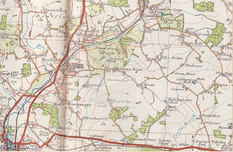
Image: Before Stansted Airport aa

Size of this preview: 800 × 525 pixels. Other resolutions: 320 × 210 pixels | 1,424 × 935 pixels.
Original image (1,424 × 935 pixels, file size: 265 KB, MIME type: image/jpeg)
Description: Where London Stansted Airport (England) is now, about 1935. Link to Google Earth map of the same area as it is now. The airport occupies roughly the area of Mott's Hall, Colchester Hall, Coopers, Bassingbourn Hall, Taylor's Wood. The red road along the bottom is the B1256.
Title: Before Stansted Airport aa
Credit: http://www.ponies.me.uk/maps/osmap.html
Author: Ordnance Survey
Usage Terms: Public domain
License: Public domain
Attribution Required?: No
Image usage
The following 2 pages link to this image:

All content from Kiddle encyclopedia articles (including the article images and facts) can be freely used under Attribution-ShareAlike license, unless stated otherwise.