
Image: Benjamin Cole02

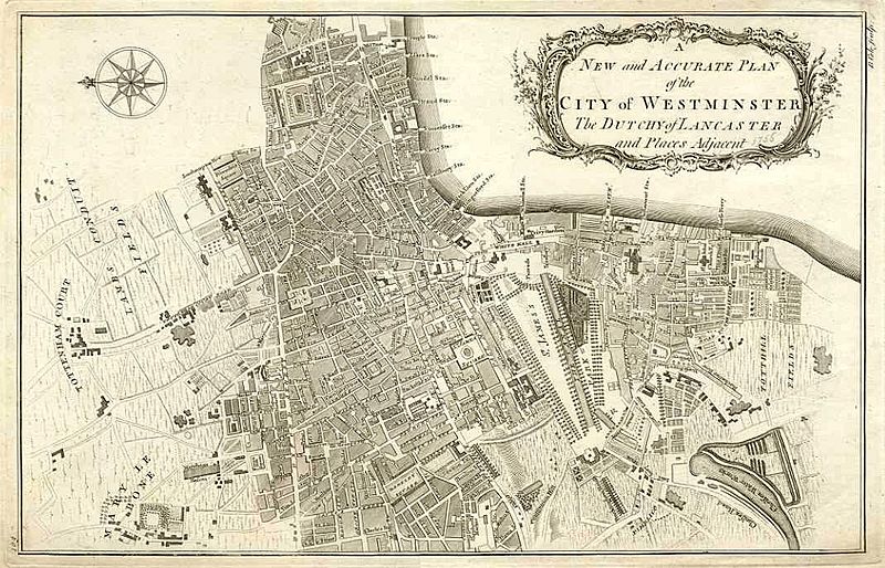
Description: "A New and Accurate Plan of the City of Westminster the Dutchy of Lancaster and Places Adjacent" by Benjamin Cole and published in 1755. The map is orientated with North to the left, and extends from Tottenham Court in the North to Chelsea water works in the South, and includes Berkley Square in the West and Lincolns Inn Fields in the East. Copper engraved map. A bibliographical account of the principal works relating to English topography (1818) affirms the publication of this map.
Title: Benjamin Cole02
Credit: Former page, which hosted the image, inaccessible (image's direct link is https://web.archive.org/web/20041109173508/http://www.rossoldbooks.co.uk/Images2/NM460.JPG)
Author: Benjamin Cole (1695–1766)
Usage Terms: Public domain
License: Public domain
Attribution Required?: No
Image usage
The following page links to this image:
