
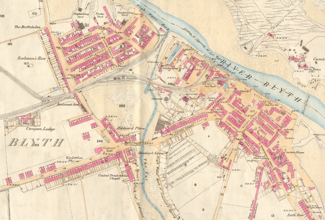
Image: Blyth map c.1860
Size of this preview: 800 × 542 pixels. Other resolutions: 320 × 217 pixels | 1,103 × 747 pixels.
Original image (1,103 × 747 pixels, file size: 755 KB, MIME type: image/jpeg)
Description: First edition Ordnance Survey map of Blyth, circa 1860
Title: Blyth map c.1860
Credit: Reproduced from the 1860 Ordnance Survey Map; obtained from http://communities.northumberland.gov.uk/004891FS.htm
Author: Ordnance Survey
Usage Terms: Public domain
License: Public domain
Attribution Required?: No
Image usage
The following page links to this image:

All content from Kiddle encyclopedia articles (including the article images and facts) can be freely used under Attribution-ShareAlike license, unless stated otherwise.