
Image: Bonaventure Plantation 1779

Size of this preview: 472 × 599 pixels. Other resolutions: 189 × 240 pixels | 808 × 1,026 pixels.
Original image (808 × 1,026 pixels, file size: 399 KB, MIME type: image/png)
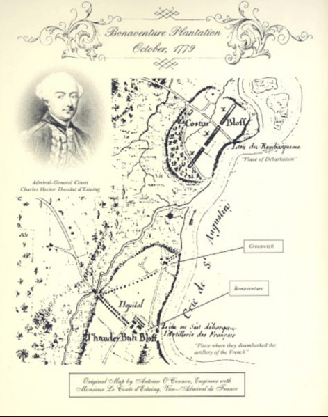
Description: A map of the w:Bonaventure Plantation and its immediate surroundings in October 1779.
Title: Bonaventure Plantation 1779
Credit: Original publication: He drew the map in October 1779 or just before Immediate source: http://bonaventure.georgiastatedar.org/chapter.php
Author: Antoine O'Connor (Life time: After 1779)
Usage Terms: Public domain
License: Public domain
Attribution Required?: No
Image usage
The following 2 pages link to this image:

All content from Kiddle encyclopedia articles (including the article images and facts) can be freely used under Attribution-ShareAlike license, unless stated otherwise.