
Image: BorahPeakID

Size of this preview: 800 × 441 pixels. Other resolutions: 320 × 176 pixels | 1,089 × 600 pixels.
Original image (1,089 × 600 pixels, file size: 125 KB, MIME type: image/jpeg)
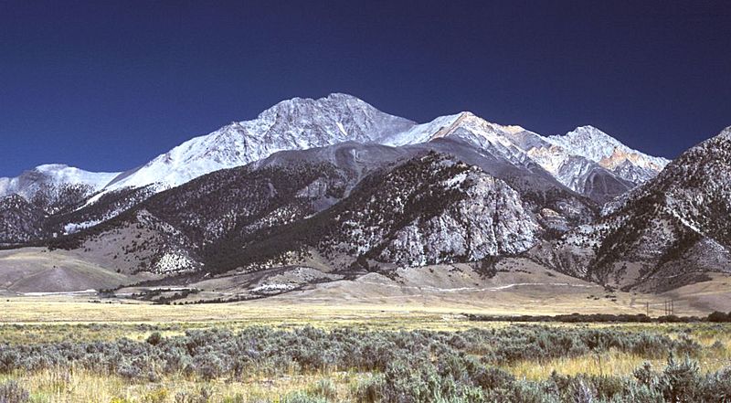
Description: Borah Peak, Idaho, looking east. The normal climbing route begins in the wooded canyon at center left. The white line running along the base of the peak is the fault trace from the 1983 earthquake.
Title: BorahPeakID
Credit: Transferred from en.wikipedia to Commons by RedWolf using CommonsHelper.
Author: G. Thomas at English Wikipedia
Usage Terms: Public domain
License: Public domain
Attribution Required?: No
Image usage
The following 18 pages link to this image:
- Borah Peak
- Central Idaho
- List of U.S. states and territories by elevation
- List of U.S. states by elevation
- List of Ultras of the Rocky Mountains
- List of Ultras of the United States
- List of mountains of the United States
- List of the highest major summits of the United States
- List of the major 100-kilometer summits of the Rocky Mountains
- List of the major 100-kilometer summits of the United States
- List of the major 3000-meter summits of the Rocky Mountains
- List of the major 3000-meter summits of the United States
- List of the major 4000-meter summits of the Rocky Mountains
- List of the major 4000-meter summits of the United States
- List of the most isolated major summits of the United States
- List of the most prominent summits of the United States
- Lost River Range
- Mountain states

All content from Kiddle encyclopedia articles (including the article images and facts) can be freely used under Attribution-ShareAlike license, unless stated otherwise.