
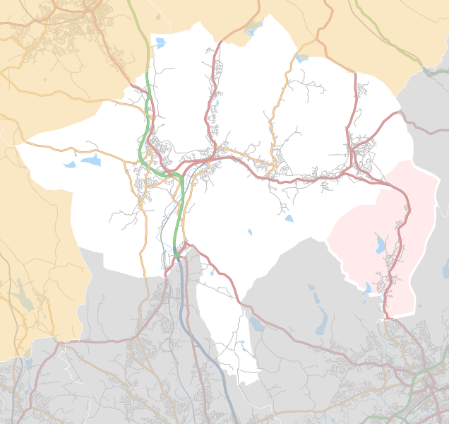
Image: Borough of Rossendale parishes map

Description: Map of the one civil parish in the Borough of Rossendale, Lancashire, England. Equirectangular map projection on WGS 84 datum, with N/S stretched 165% Geographic limits: West: 2.42 °W East: 2.14 °W North: 53.76 °N South: 53.60 °N Key Whitworth
Title: Borough of Rossendale parishes map
Credit: This file was derived from: Rossendale UK ward map 2010 (blank).svg: Lancashire UK parish map (blank).svg: http://www.openstreetmap.org/#map=12/53.6848/-2.2831
Author: Rossendale UK ward map 2010 (blank).svg: Nilfanion, created using Ordnance Survey data Lancashire UK parish map (blank).svg: Nilfanion, created using Ordnance Survey data OpenStreetMap: OpenStreetMap contributors derivative work: Dr Greg
Usage Terms: Creative Commons Attribution-Share Alike 4.0
License: CC BY-SA 4.0
License Link: http://creativecommons.org/licenses/by-sa/4.0
Attribution Required?: Yes
Image usage
The following 2 pages link to this image:
