
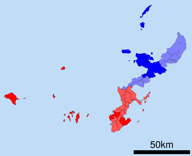
Image: Boundaries of the Okinawan Languages

Description: A map of the Okinawan Islands displaying the distribution of the Northern Okinawan Language (Kunigami) in blue, and the South-Central Okinawan Language (Shuri-Naha) in red. The darker areas represent regions that have been officially classified by the following sources: Lewis, M. Paul (2009). "Ethnologue report for Japan". Ethnologue: Languages of the World, Sixteenth edition. Dallas, Texas: SIL International. Pellard, Thomas (2009). "Ogami: Éléments de description d'un parler du sud des Ryukyus". École des hautes études en sciences sociales. Paris, France. Curry, Stewart A. (2004). "Small Linguistics: Lexical Loans in Nakijin Dialect Okinawan". University of Hawaii Library.
Title: Boundaries of the Okinawan Languages
Credit: Map_of_Okinawa_Prefecture_Ja.svg
Author: Map_of_Okinawa_Prefecture_Ja.svg: ja: 利用者:Lincun derivative work: Io Katai (talk)
Usage Terms: Creative Commons Attribution-Share Alike 3.0
License: CC-BY-SA-3.0
License Link: http://creativecommons.org/licenses/by-sa/3.0/
Attribution Required?: Yes
Image usage
The following page links to this image:
