
Image: Boundary Stone (District of Columbia) North boundary stone in Silver Spring
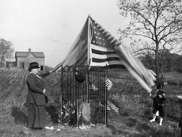
Description: Northeast No. 1 Boundary Marker Stone: Beginning with the Southern corner a survey party, lead by Andrew Ellicott, placed stones one mile apart to mark the boundary of the District of Columbia. The Southern corner stone was erected with great ceremony on April 15, 1791 on Jones Point along the Potomac River in Virginia. It was the Residence Act of 1790 that authorized President Washington h locate new federal city along the Potomac River. In 1847 the Virginia portion of the District was returned to the state by the federal government. In 1916 the Daughters of the American Revolution erected fencing to preserve the remaining stones. Washington, D.C. and Silver Spring, Maryland Ca. 1916
Title: Boundary Stone (District of Columbia) North boundary stone in Silver Spring
Credit: https://www.flickr.com/photos/dcplcommons/3359937479/
Author: DC Public Library Commons
Permission: At the time of upload, the image license was automatically confirmed using the Flickr API. For more information see Flickr API detail.
Usage Terms: No known copyright restrictions
License: No restrictions
License Link: https://www.flickr.com/commons/usage/
Attribution Required?: No
Image usage
The following page links to this image:

_North_boundary_stone_in_Silver_Spring.jpg)