
Image: Bowen Mexico or New Spain 1752 UTA
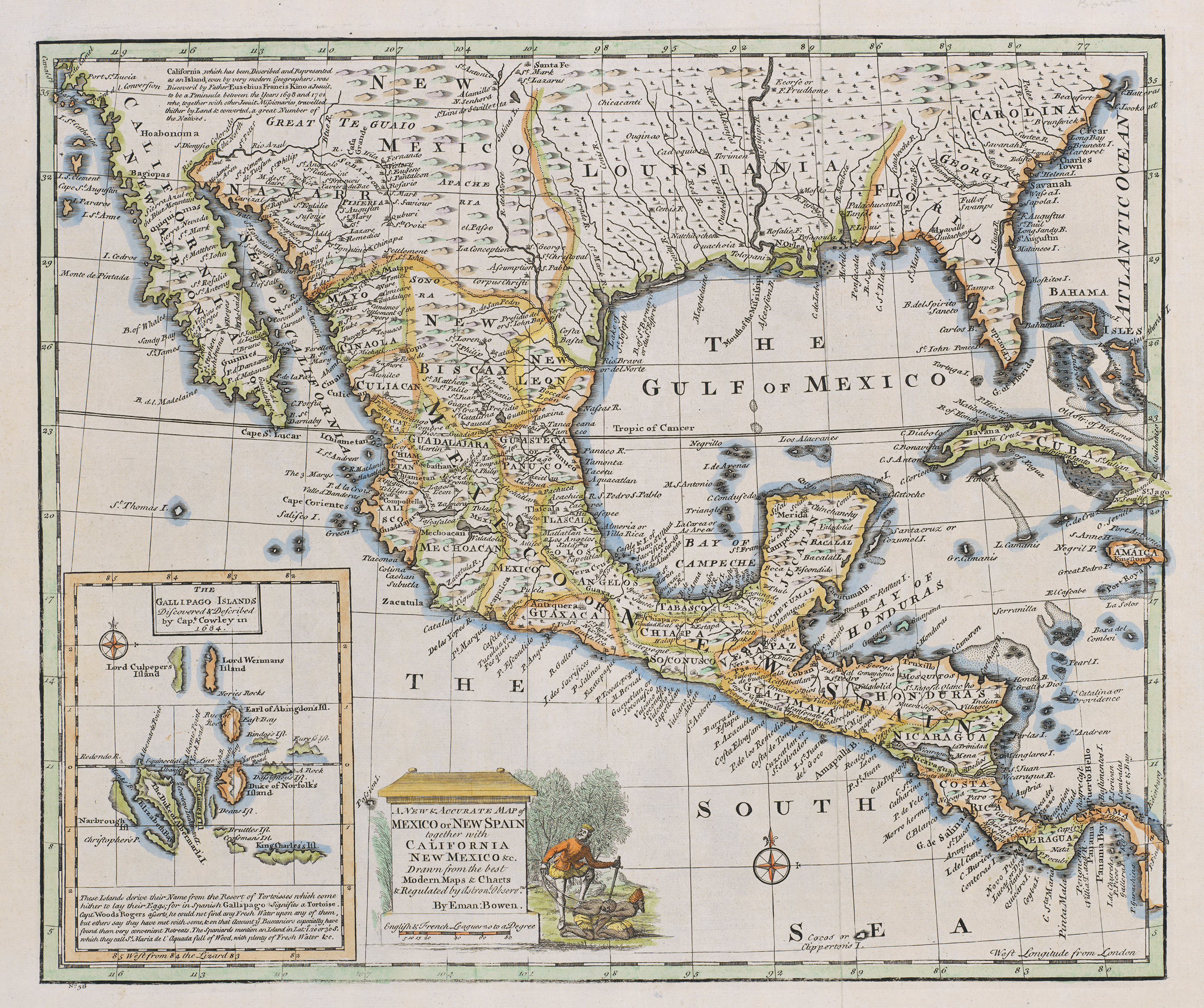
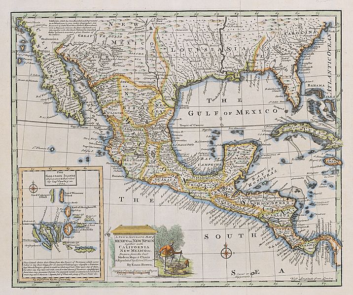
Description: The cartouche of this map of New Spain depicts a European mishandling a couple of Native American captives. The image dates at least back to 1729 when Peter Van der Aa included an identical image on his cartouche of a map of Mexico or New Spain appearing in Abraham du Bois' La Geographie Moderne, published in Leiden at that date. Such images, repeated over and over, contributed to the Spanish "Black Legend" – the idea that the Spanish treated Indians worse than their Anglo-Protestant peers, many of whom behaved equally bad in reality. Bowen's inset depicts the Galápagos Islands based upon descriptions and charts by English sea captains William A. Cowley and Woodes Rogers. Despite the "modern" scientific jargon with reference to "astronomical observations", English engraver, cartographer, publisher and print-seller Emanuel Bowen, even as Geographer to His Majesty, did not have access to accurate field information for much of the territories depicted – no one would until the mid-nineteenth century. His map shows Santa Fe along the 101st meridian instead of its actual location along the 105th, with the result that New Mexico lies four degrees of longitude east of its true location, and the area of present west Texas is considerably condensed.
Title: A New & Accurate Map of Mexico or New Spain together with California, New Mexico &c
Credit: UTA Libraries Cartographic Connections: map / text
Author: Emanuel Bowen
Usage Terms: Public domain
License: Public domain
Attribution Required?: No
Image usage
The following 2 pages link to this image:
