
Image: Brit IndianEmpireReligions3
Size of this preview: 741 × 599 pixels. Other resolutions: 297 × 240 pixels | 1,534 × 1,241 pixels.
Original image (1,534 × 1,241 pixels, file size: 2.33 MB, MIME type: image/jpeg)
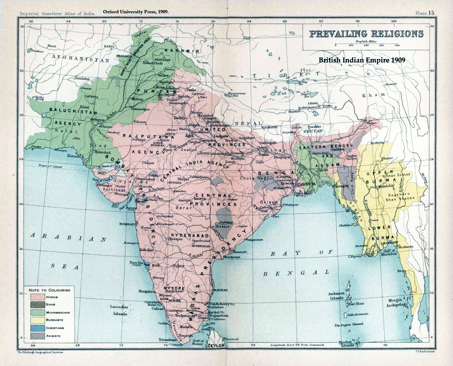
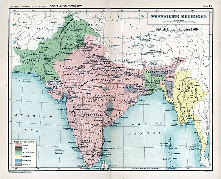
Description: Map "Prevailing Religions of the British Indian Empire, 1909" Key: Pink Hindu Green Muslim Diagonal lines Sikh (small area in Punjab) Yellow Buddhist (Burma and Chittagong Hill Tracts) Blue Christian (Goa) Purple Animist (several inland hilly areas) Ceylon and the Andaman islands are not mapped.
Title: Brit IndianEmpireReligions3
Credit: The Imperial Gazetteer of India, Oxford University Press, 1909. Scanned from personal copy and annotated by me (Fowler&fowler«Talk» 04:16, 19 March 2007 (UTC))
Author: John George Bartholomew
Usage Terms: Public domain
License: Public domain
Attribution Required?: No
Image usage
The following 6 pages link to this image:

All content from Kiddle encyclopedia articles (including the article images and facts) can be freely used under Attribution-ShareAlike license, unless stated otherwise.