
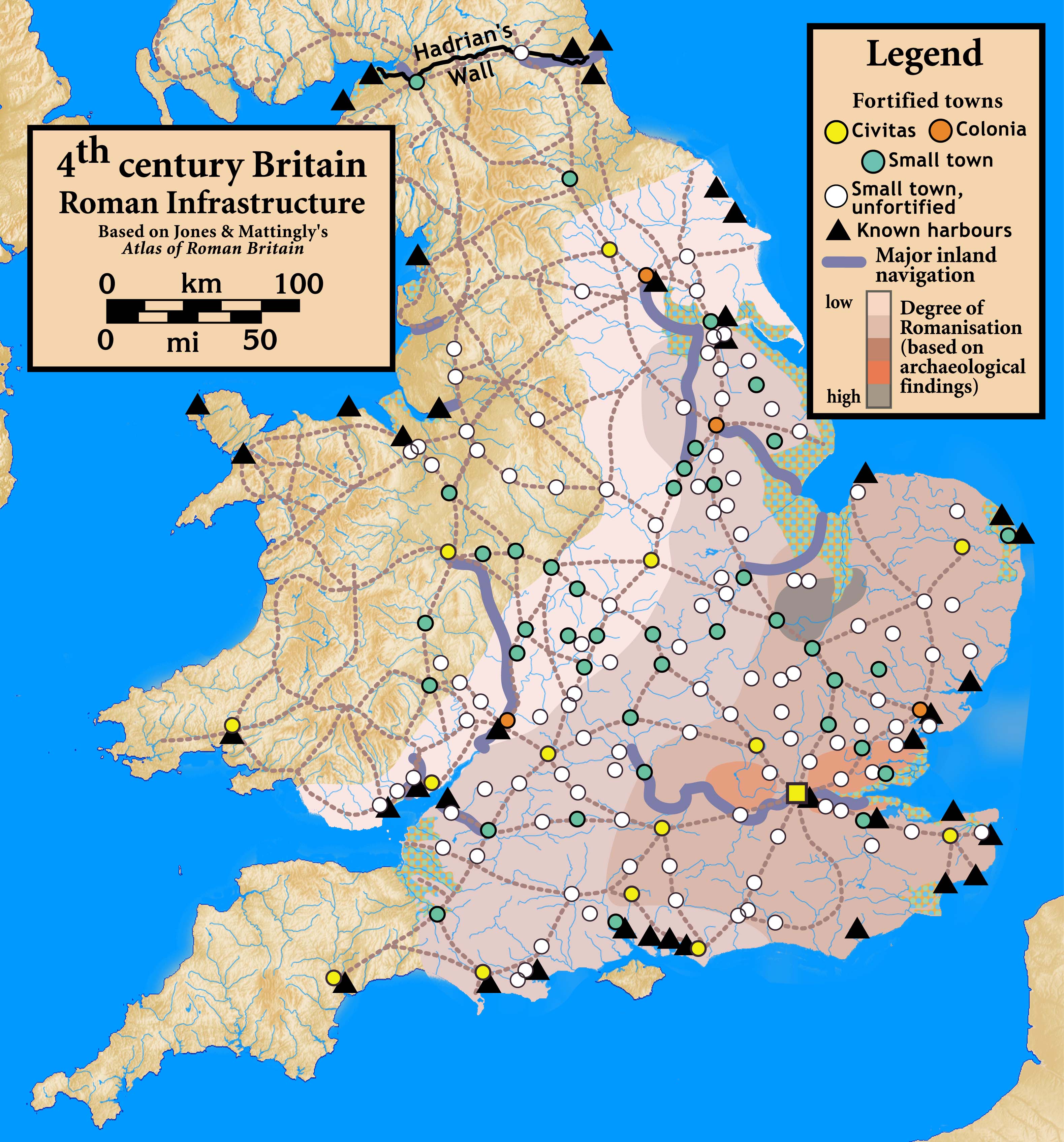
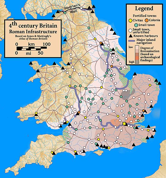
Image: Britain.4th.century.Roman.infrastructure
Description: Roman Infrastructure in 4th century Britain
Title: Britain.4th.century.Roman.infrastructure
Credit: Based on Jones & Mattingly's Atlas of Roman Britain (ISBN 978-1-84217-06700, 1990, reprinted 2007) — the source is cited in the image legend — locations of towns (fortified and unfortified) are given on p. 156, with tribal civitates and coloniae specified on p. 154; major inland waterways are from p. 199; the degree of Romanisation ("boundaries of acculturation" with levels from "high density" to "low density" in the text) are given on page 151, with the authors citing it as a computer-generated map based on data contained in the standard Ordnance Survey map of Roman Britain; roads are from several sources, including the Antonine Itinerary. The topographical map is from a sub-region of File:Uk topo en.jpg, with the copyright notice Template:Bild-GFDL-GMT and original date of 7 July 2006, copy made in 2008, with the annotations removed by myself.
Author: my work
Usage Terms: Creative Commons Attribution-Share Alike 3.0
License: CC BY-SA 3.0
License Link: https://creativecommons.org/licenses/by-sa/3.0
Attribution Required?: Yes
Image usage
The following page links to this image:
