
Image: BritishEmpire1919
Size of this preview: 800 × 409 pixels. Other resolutions: 320 × 163 pixels | 1,425 × 728 pixels.
Original image (1,425 × 728 pixels, file size: 61 KB, MIME type: image/png)
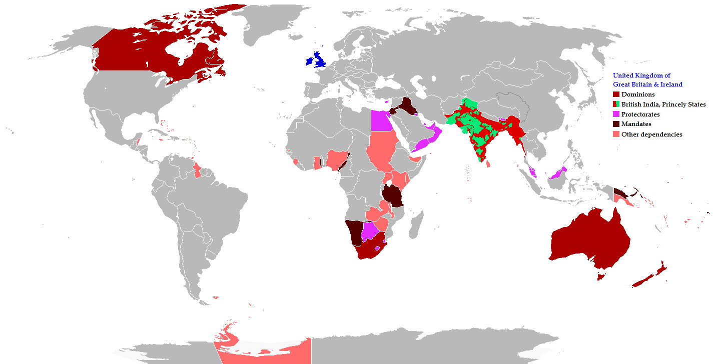
Description: Map of the British Empire in 1919 showing all the territories, including the dominions, colonies, protectorates and mandates, ruled or administered by the United Kingdom and its successor states during that year.
Title: BritishEmpire1919
Credit: The following: India under British rule British colonisation of the Americas Colonies of European powers in Africa History of Oceania History of the Middle East
Author: Maps & Lucy
Permission: Released into the public domain (by the author).
Usage Terms: Creative Commons Attribution-Share Alike 2.5
License: CC BY-SA 2.5
License Link: http://creativecommons.org/licenses/by-sa/2.5
Attribution Required?: Yes
Image usage
The following page links to this image:

All content from Kiddle encyclopedia articles (including the article images and facts) can be freely used under Attribution-ShareAlike license, unless stated otherwise.