
Image: BritishWestFlorida1776

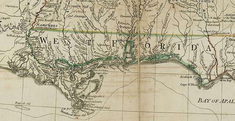
Description: The source map depicts the southern British colonies in 1776, including the Carolinas, Georgia, and the Floridas, as well as labeling Indian tribal regions. This detail depicts British West Florida, roughly including the Gulf Coast between the Mississippi River and the Apalachicola River.
Title: BritishWestFlorida1776
Credit: From the Darlington Digital Library at the University of Pittsburgh, identifier DARMAP0298: http://images.library.pitt.edu/cgi-bin/i/image/image-idx?med=1;image_search%20btn=Go;q1=florida;rgn1=darlmaps_all;sid=9f1d2a0afbb2d02f51e12f6a87a01616;size=20;c=darlmaps;lasttype=boolean;view=entry;lastview=thumbnail;subview=detail;cc=darlmaps;entryid=x-darmap0298;viewid=DARMAP0298.TIF;start=1;resnum=7
Author: Bernard Romans
Usage Terms: Public domain
License: Public domain
Attribution Required?: No
Image usage
The following 6 pages link to this image:
