
Image: Browns Valley flood 07
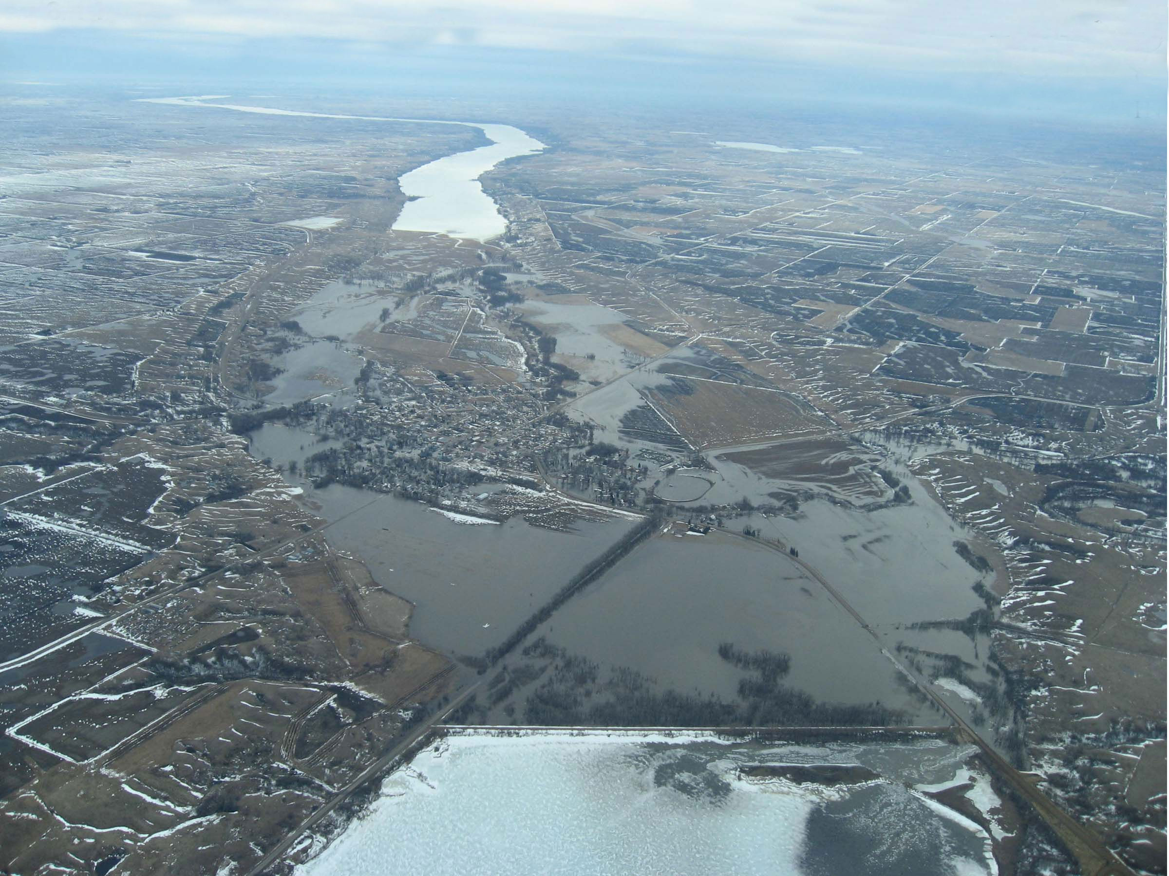
Description: Aerial photograph showing the Traverse Gap in Minnesota and South Dakota and flooding at Browns Valley, Minnesota, from ice-covered Lake Traverse (bottom of frame), south to Big Stone Lake (top of image). Interbasin flooding is shown: The Little Minnesota River, which originates in the Mississippi watershed, enters the Traverse Gap from the west (right) and flows south to Big Stone Lake, is flooding the gap and Browns Valley (center); at the lower right floodwaters are crossing the continental divide into Lake Traverse in the watershed of Hudson Bay.
Title: Browns Valley flood 07
Credit: JOR Engineering, Inc.
Author: JOR Engineering, Inc.
Permission: "I agree to publish/allow publication of that work under the free license known as the 'GNU Free Documentation License'" . . . This work is free and may be used by anyone for any purpose. If you wish to use this content, you do not need to request permission as long as you follow any licensing requirements mentioned on this page. Wikimedia has received an e-mail confirming that the copyright holder has approved publication under the terms mentioned on this page. This correspondence has been reviewed by an OTRS member and stored in our permission archive. The correspondence is available to trusted volunteers here. If you have questions about the archived correspondence, please use the OTRS noticeboard. Ticket link: https://secure.wikimedia.org/otrs/index.pl?Action=AgentTicketZoom&TicketID=880546
Usage Terms: Creative Commons Attribution-Share Alike 3.0
License: CC-BY-SA-3.0
License Link: http://creativecommons.org/licenses/by-sa/3.0/
Attribution Required?: Yes
Image usage
The following 2 pages link to this image:
