
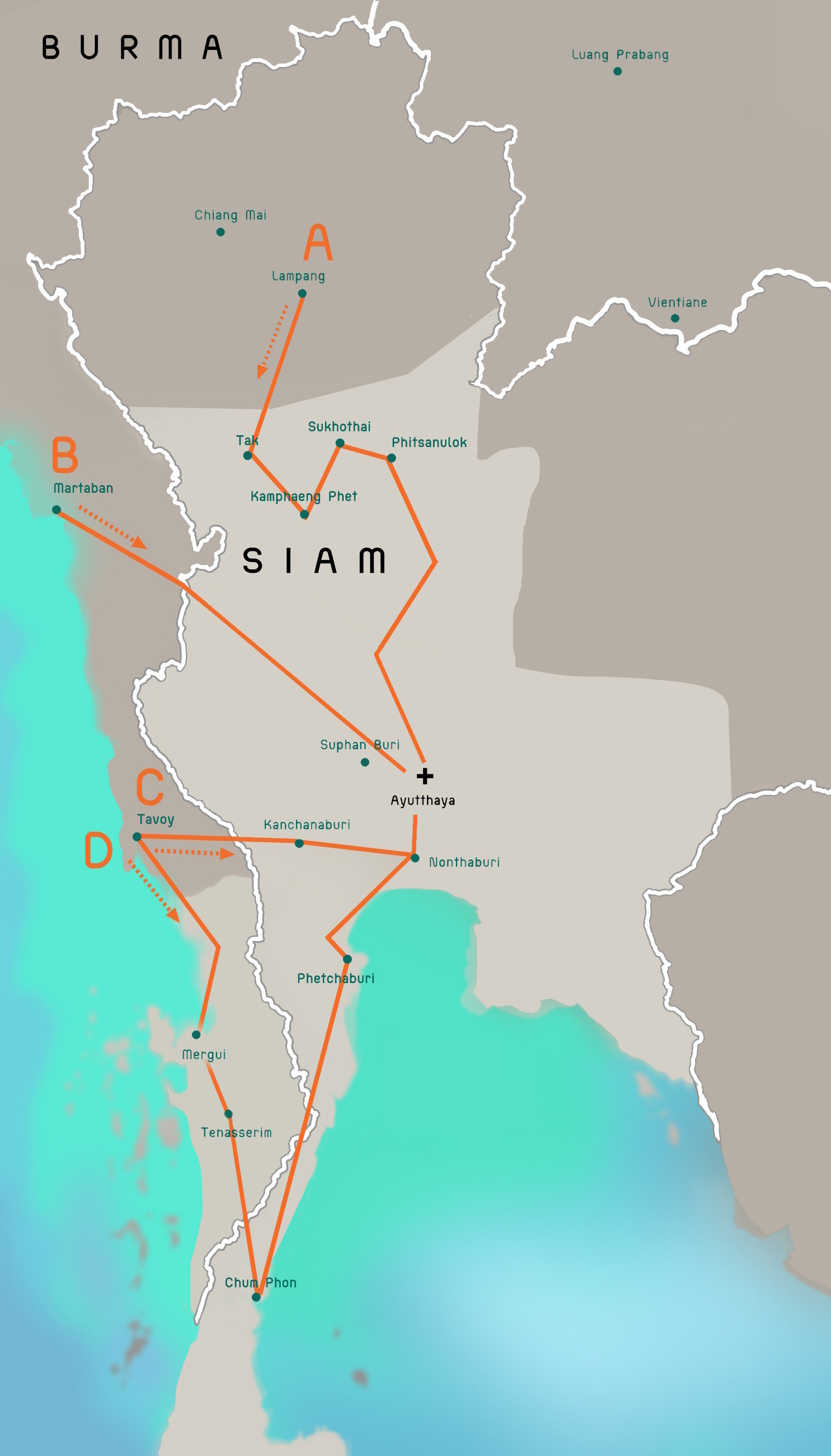
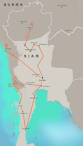
Image: Burmese-Siamese war (1765-1767) map - EN - 001
Description: This is a sketch-map of advance of Burmese troops towards Ayutthaya City, in the Burmese-Siamese War (1765-1767): Line A: Lampang - Tak - Kamphaeng Phet - Sukhothai - Phitsanulok - Ayutthaya; Line B: Martaban - Suphan Buri - Ayutthaya; Line C: Tavoy - Kanchanaburi - Nonthaburi - Ayutthaya; Line D: Tavoy - Mergui - Tenasserim - Chum Phon - Phetchaburi - Nonthaburi - Ayutthaya. In this map: The territories showed are those at the time being; 00 Light grey = Siamese territories; 00 Dark grey = Burma and her vassals (Vientiane, Luang Prabang, etc.); 00 Pale taupe = Third territories (Cambodia, etc.); 00 The white and grey line = Present-day borders; 00 Orange = Advance of Burmese troops as described above. The map is modeled on File:Burmese-Siamese-war-1765-1767.PNG and File:Thailand location map.svg. The font used is TP Tankhun, a free font. This sketch-map is provided for illustrative purposes only.
Title: Burmese-Siamese war (1765-1767) map - EN - 001
Credit: Own work Baker, Chris. Phongpaichit, Pasuk. A History of Ayutthaya: Siam in the Early Modern World. Urban Places in the Seventeenth Century Map. Stuart-Fox, Martin. A History of Laos. Mainland Southeast Asia mid-16th to early-19th centuries Map.
Author: Aristitleism
Usage Terms: Creative Commons Zero, Public Domain Dedication
License: CC0
License Link: http://creativecommons.org/publicdomain/zero/1.0/deed.en
Attribution Required?: No
Image usage
The following page links to this image:

_map_-_EN_-_001.jpg)