
Image: BurnedFalmouthPaintedMap1775
Size of this preview: 800 × 532 pixels. Other resolutions: 320 × 213 pixels | 2,271 × 1,509 pixels.
Original image (2,271 × 1,509 pixels, file size: 2.36 MB, MIME type: image/png)
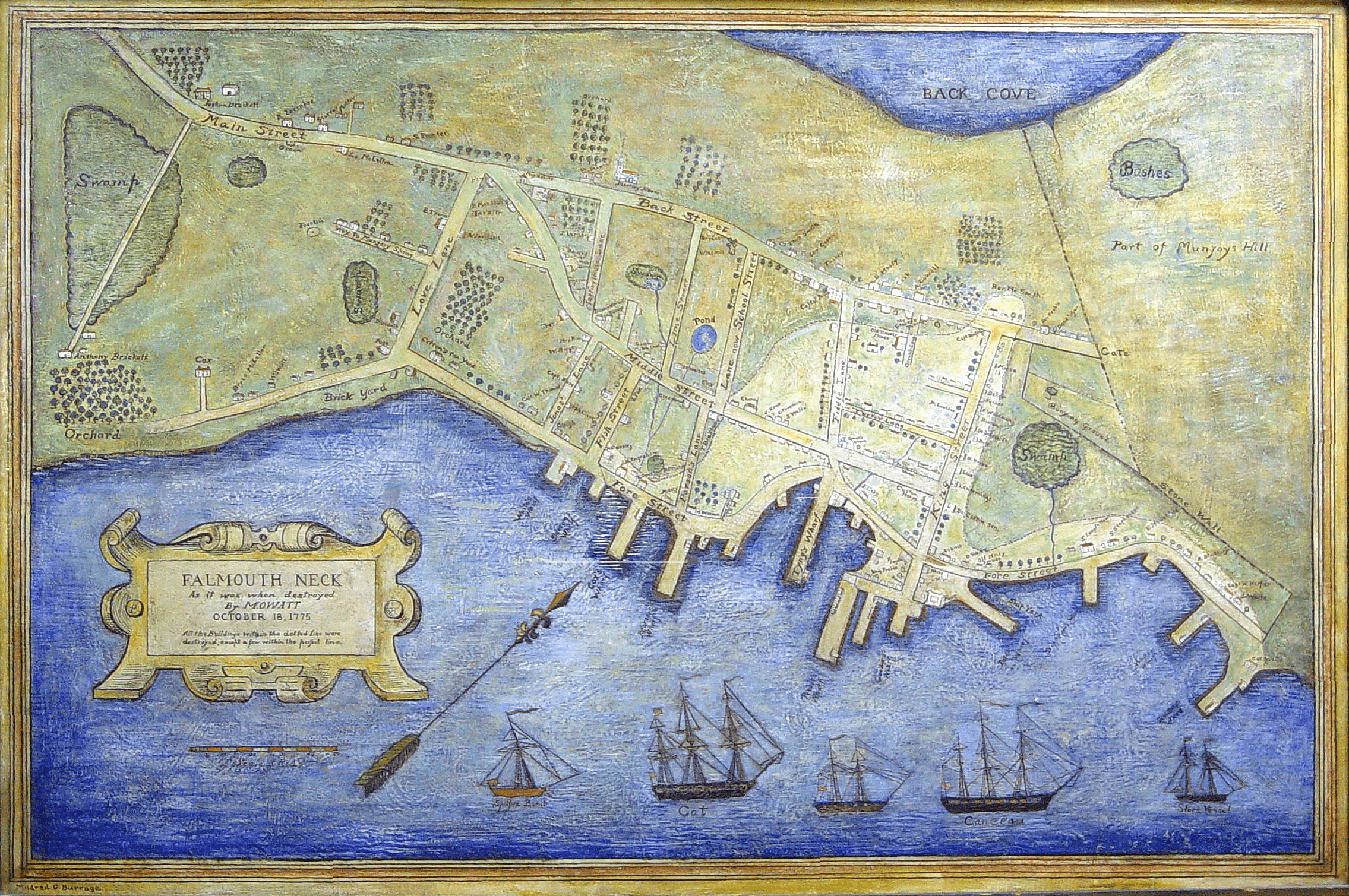
Description: Caption: Falmouth Neck as it was when destroyed by Mowatt, October 18, 1775 This is a painted version of a map that was originally created in 1850 and published by Bailey & Noyes of Portland.
Title: BurnedFalmouthPaintedMap1775
Credit: From the Maine Memory Network of the Maine Historical Society. Item number: 16128 URL: http://www.mainememory.net/bin/Detail?ln=16128
Author: Mildred Burridge
Usage Terms: Public domain
License: Public domain
Attribution Required?: No
Image usage
The following 2 pages link to this image:

All content from Kiddle encyclopedia articles (including the article images and facts) can be freely used under Attribution-ShareAlike license, unless stated otherwise.