
Image: Buru tpc 1967
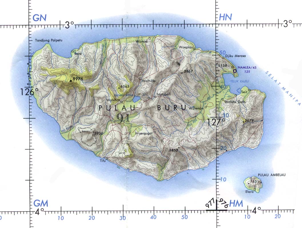
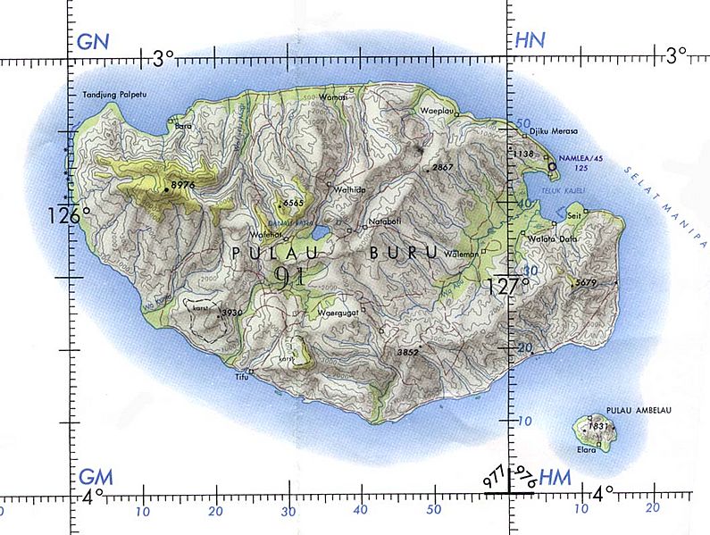
Description: Buru Island (Operational Navigation Chart) original scale 1:1,000,000. Portion of Defense Mapping Agency ONC M-12 1967 (152K) Not for navigational use This image is a copy or a derivative work of http://www.lib.utexas.edu/maps/middle_east_and_asia/buru_tpc_1967.jpg, from the map collection of the Perry–Castañeda Library (PCL) of the University of Texas at Austin. This tag does not indicate the copyright status of the attached work. A normal copyright tag is still required. See Commons:Licensing for more information.
Title: Buru tpc 1967
Credit: Originally from en.wikipedia; description page is (was) here 05:59, 4 January 2005 Davenbelle 1057x797 (152,064 bytes) (# Buru Island (Operational Navigation Chart) original scale 1:1,000,000. Portion of Defense Mapping Agency ONC M-12 1967 (152K) Not for navigational use )
Author: User Davenbelle on en.wikipedia
Usage Terms: Public domain
License: Public domain
Attribution Required?: No
Image usage
The following page links to this image:
