
Image: CAmerica

Size of this preview: 800 × 600 pixels. Other resolutions: 320 × 240 pixels | 1,800 × 1,350 pixels.
Original image (1,800 × 1,350 pixels, file size: 385 KB, MIME type: image/gif)
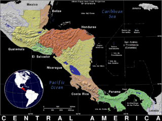
Description: A topographical map of the region encompassing the Mesoamerican Biological Corridor and Central American mountain ranges.
Title: CAmerica
Credit: http://ian.macky.net/pat/map/camr/camrblk.gif
Author: Ian Macky
Usage Terms: Creative Commons Attribution 3.0
License: CC BY 3.0
License Link: http://creativecommons.org/licenses/by/3.0
Attribution Required?: Yes
Image usage
The following page links to this image:

All content from Kiddle encyclopedia articles (including the article images and facts) can be freely used under Attribution-ShareAlike license, unless stated otherwise.