
Image: CSA states evolution
Size of this preview: 800 × 542 pixels. Other resolutions: 320 × 217 pixels | 1,000 × 677 pixels.
Original image (1,000 × 677 pixels, file size: 245 KB, MIME type: image/gif, looped, 38 frames, 1 min 53 s)
Note: Due to technical limitations, thumbnails of high resolution GIF images such as this one will not be animated.
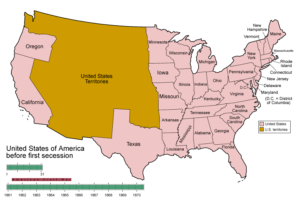
Description: Animated map/timeline of the territorial evolution of the Confederate States of America, from first secession to end of Reconstruction.
Title: CSA states evolution
Credit: Own work
Author: User:Golbez
Usage Terms: Creative Commons Attribution-Share Alike 3.0
License: CC-BY-SA-3.0
License Link: http://creativecommons.org/licenses/by-sa/3.0/
Attribution Required?: Yes
Image usage
The following page links to this image:

All content from Kiddle encyclopedia articles (including the article images and facts) can be freely used under Attribution-ShareAlike license, unless stated otherwise.