
Image: Cabin Creek WV map
Size of this preview: 622 × 600 pixels. Other resolutions: 249 × 240 pixels | 2,499 × 2,409 pixels.
Original image (2,499 × 2,409 pixels, file size: 5.68 MB, MIME type: image/png)
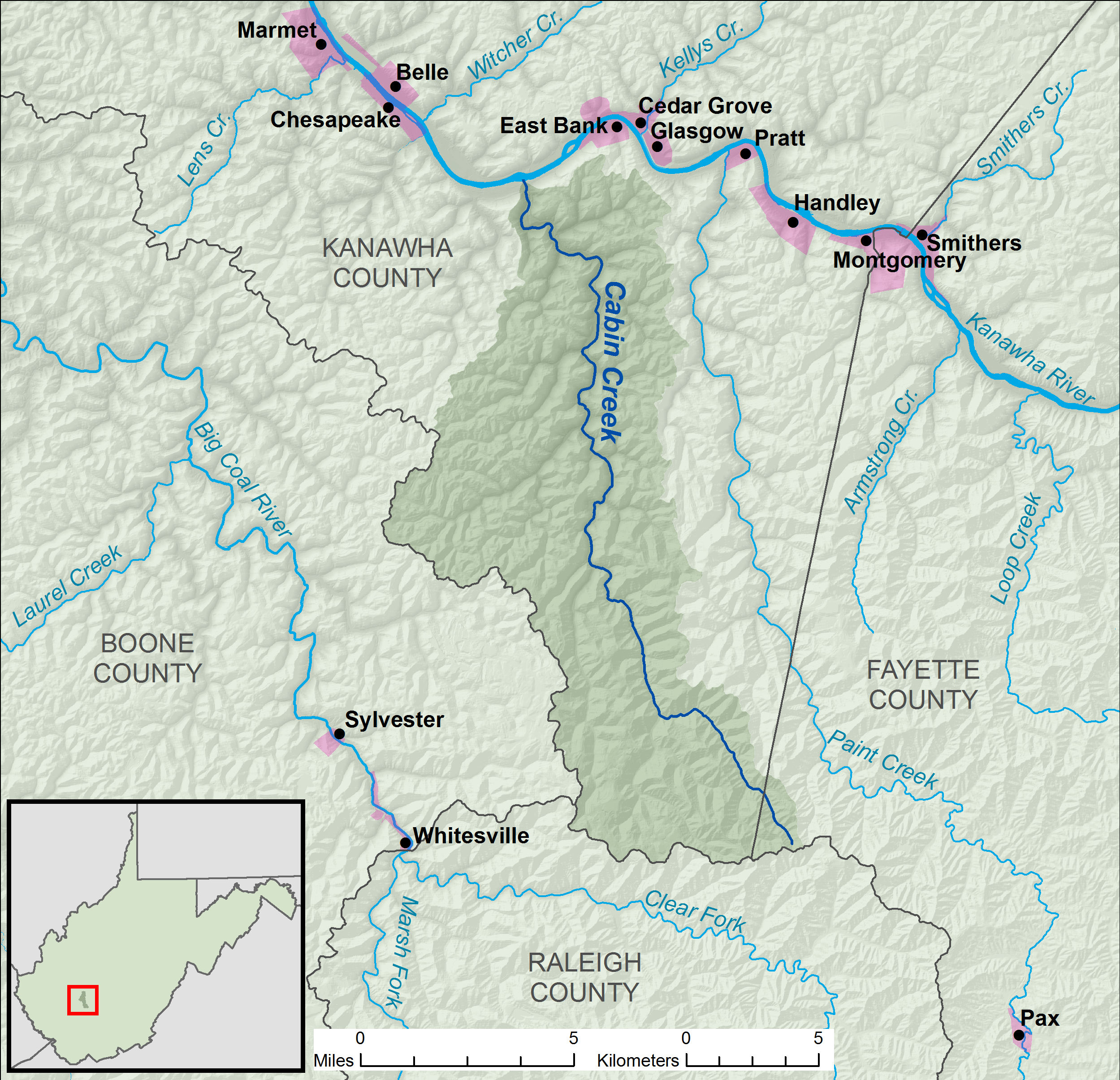
Description: A map of Cabin Creek and its watershed (USGS HUC-10 code 0505000602), in Kanawha and Fayette counties in West Virginia.
Title: Cabin Creek WV map
Credit: Own work, data from w:The National Map
Author: Tim Kiser (User:Malepheasant)
Usage Terms: Creative Commons Attribution-Share Alike 3.0
License: CC BY-SA 3.0
License Link: https://creativecommons.org/licenses/by-sa/3.0
Attribution Required?: Yes
Image usage
The following page links to this image:

All content from Kiddle encyclopedia articles (including the article images and facts) can be freely used under Attribution-ShareAlike license, unless stated otherwise.