
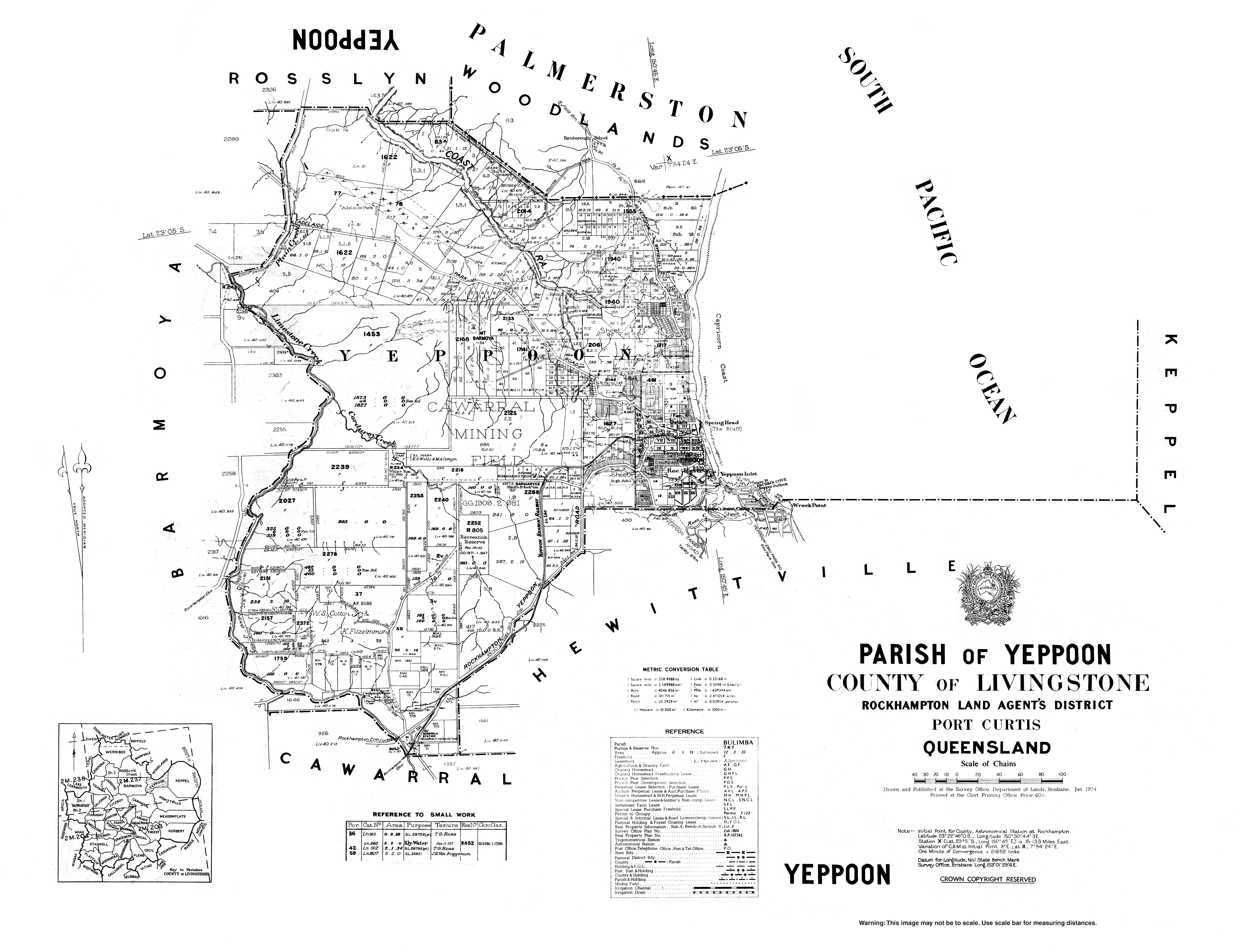
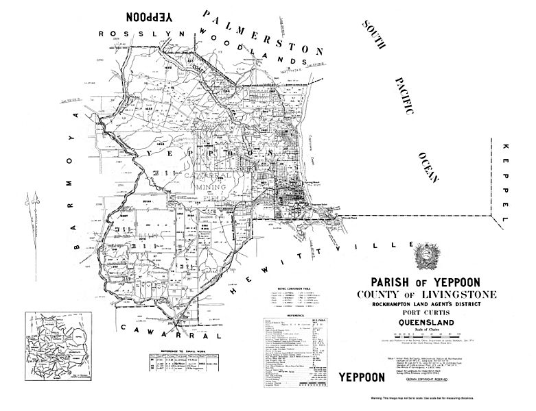
Image: Cad-map-40chain-parish-yeppoon-1974
Size of this preview: 781 × 600 pixels. Other resolutions: 313 × 240 pixels | 7,340 × 5,636 pixels.
Original image (7,340 × 5,636 pixels, file size: 3.51 MB, MIME type: image/jpeg)
Description: Cadastral map of the Parish of Yeppoon displaying real property information and Administrative Areas including Parish; County and Land Agents District
Title: Cad-map-40chain-parish-yeppoon-1974
Credit: https://gisservices.information.qld.gov.au/arcgis/rest/directories/historicalscans/cad_scans/cad-map-40chain-parish-yeppoon-1974.jpg
Author: Survey Office, Department of Lands, Brisbane
Usage Terms: Creative Commons Zero, Public Domain Dedication
License: CC0
License Link: http://creativecommons.org/publicdomain/zero/1.0/deed.en
Attribution Required?: No
Image usage
The following page links to this image:

All content from Kiddle encyclopedia articles (including the article images and facts) can be freely used under Attribution-ShareAlike license, unless stated otherwise.