
Image: Cairn near Carn Fflur's west top - geograph.org.uk - 518650
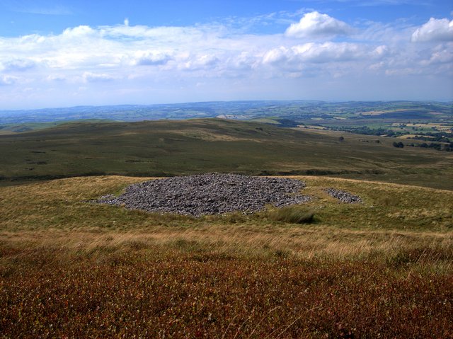
Description: Cairn near Carn Fflur's west top This structure, marked as a cairn on the map, is actually a flat area covered in rocks. It is likely that, rather than being used for orientation, it was a ring shelter used by drovers to protect animals driven across the Elenydd from the weather. There are several such structures on the nearby hills. These days, most of the square, including the main summit of Carn Fflur, is covered in forest. The rest, along the western edge and in SW, is rough grazing.
Title: Cairn near Carn Fflur's west top - geograph.org.uk - 518650
Credit: From geograph.org.uk
Author: Rudi Winter
Usage Terms: Creative Commons Attribution-Share Alike 2.0
License: CC BY-SA 2.0
License Link: https://creativecommons.org/licenses/by-sa/2.0
Attribution Required?: Yes
Image usage
The following page links to this image:
