
Image: Calig2en

Size of this preview: 800 × 473 pixels. Other resolutions: 320 × 189 pixels | 2,000 × 1,183 pixels.
Original image (2,000 × 1,183 pixels, file size: 189 KB, MIME type: image/png)
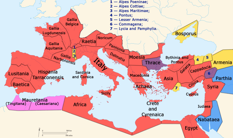
Description: Map of the Roman Empire and neighboring states during the reign of Gaius Caligula (37-41 AD). Italy and Roman provinces Independent countries Client states (Roman puppets) Mauretania seized by Caligula Former Roman provinces Thrace and Commagena made client states by Caligula
Title: Calig2en
Credit: Own work, based on File:Blank map of South Europe and North Africa.svg (CC-BY-SA-3.0)
Author: Homoatrox
Usage Terms: Creative Commons Attribution-Share Alike 4.0
License: CC BY-SA 4.0
License Link: https://creativecommons.org/licenses/by-sa/4.0
Attribution Required?: Yes
Image usage
The following page links to this image:

All content from Kiddle encyclopedia articles (including the article images and facts) can be freely used under Attribution-ShareAlike license, unless stated otherwise.