
Image: Camajuani Map
No higher resolution available.
Camajuani_Map.png (328 × 532 pixels, file size: 21 KB, MIME type: image/png)
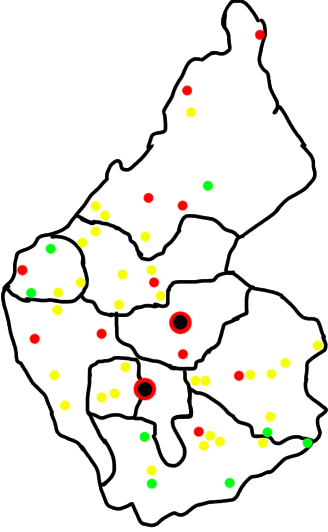
Description: Map of Camajuaní’s Wards and towns. Black with red dots are the 2 major cities (Camajuaní and Vueltas). The red dots are popular areas for tourism (like Playa Juan Francisco) and larger towns (like Taguaybon, La Quinta, etc) yellow are small towns, hamlets, and CPA (like Crucero Carmita, Tarafa, and Puente Pavon) and green are populated regions not on the map I based this on but on OSM.
Title: Camajuani Map
Credit: Own work
Author: CubanoBoi
Usage Terms: Creative Commons Attribution-Share Alike 4.0
License: CC BY-SA 4.0
License Link: https://creativecommons.org/licenses/by-sa/4.0
Attribution Required?: Yes
Image usage
The following page links to this image:

All content from Kiddle encyclopedia articles (including the article images and facts) can be freely used under Attribution-ShareAlike license, unless stated otherwise.