
Image: Canada Alberta location map 2

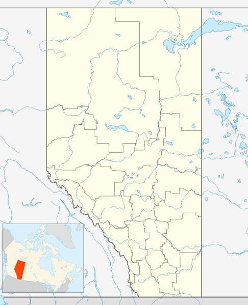
Description: Location map of Alberta, Canada, showing the 19 census divisions. Equirectangular projection, N/S stretching 170%. Geographic limits of the map: N: 60.3° N S: 48.7° N W: 123.0° W E: 107.0° W
Title: Canada Alberta location map 2
Credit: Own work, File:Canada Alberta location map.svg by NordNordWest
Author: Hanhil (talk) 05:35, 24 September 2009 (UTC)
Permission: I, the copyright holder of this work, hereby publish it under the following license:
Usage Terms: Creative Commons Attribution-Share Alike 3.0
License: CC BY-SA 3.0
License Link: https://creativecommons.org/licenses/by-sa/3.0
Attribution Required?: Yes
Image usage
More than 100 pages link to this image. The following list shows the first 100 page links to this image only. A full list is available.
- 2016 Fort McMurray wildfire
- Acadia Valley
- Acheson, Alberta
- Acme, Alberta
- Adams Landing
- Aden, Alberta
- Airdrie, Alberta
- Alberta Beach
- Albright, Alberta
- Alcurve, Alberta
- Alderson, Alberta
- Aldersyde, Alberta
- Alexander Indian Reserve No
- Alexo, Alberta
- Alhambra, Alberta
- Alix, Alberta
- Allerston, Alberta
- Alliance, Alberta
- Alsike, Alberta
- Amber Valley, Alberta
- Amesbury, Alberta
- Amisk, Alberta
- Anastasia, Alberta
- Andrew, Alberta
- Ansell, Alberta
- Anthracite, Alberta
- Anzac, Alberta
- Ardmore, Alberta
- Ardrossan, Alberta
- Argentia Beach
- Armena
- Arrowwood, Alberta
- Ashmont, Alberta
- Askow, Alberta
- Athabasca, Alberta
- Atikameg, Alberta
- Atlee, Alberta
- Atmore, Alberta
- Avenir, Alberta
- Azure, Alberta
- Balzac, Alberta
- Banff, Alberta
- Bank Bay, Alberta
- Bankview, Alberta
- Barnwell, Alberta
- Barons, Alberta
- Barrhead, Alberta
- Bashaw, Alberta
- Bassano, Alberta
- Bawlf
- Bay Tree, Alberta
- Beach Corner, Alberta
- Beacon Corner, Alberta
- Bear Canyon, Alberta
- Bearberry, Alberta
- Bearspaw, Alberta
- Beaumont, Alberta
- Beaver Mines
- Beaverlodge
- Beiseker
- Bellevue, Alberta
- Belloy, Alberta
- Benalto
- Bentley, Alberta
- Bergen, Alberta
- Berwyn, Alberta
- Betula Beach
- Beynon, Alberta
- Bezanson, Alberta
- Big Coulee, Alberta
- Big Meadow, Alberta
- Big Stone, Alberta
- Big Valley, Alberta
- Birch Cove
- Birchcliff
- Bittern Lake
- Black Diamond, Alberta
- Blackfalds
- Blairmore, Alberta
- Blood Indian Reserve No
- Bloomsbury, Alberta
- Blue Ridge, Alberta
- Blueberry Mountain, Alberta
- Bluesky, Alberta
- Boian, Alberta
- Bon Accord, Alberta
- Bonanza, Alberta
- Bondiss
- Bonnyville
- Breynat, Alberta
- Calgary
- Fort McMurray
- Harmony, Alberta
- Lacombe, Alberta
- Lethbridge
- Medicine Hat
- Onoway
- Red Deer, Alberta
- Sexsmith, Alberta
- Swalwell, Alberta
