
Image: Canada Manitoba location map 2

Size of this PNG preview of this SVG file: 486 × 599 pixels. Other resolution: 195 × 240 pixels.
Original image (SVG file, nominally 1,512 × 1,864 pixels, file size: 599 KB)
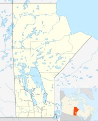
Description: Location map of Manitoba, Canada
Title: Canada Manitoba location map 2
Credit: Own work, File:Canada_Manitoba_location_map.svg by NordNordWest
Author: Hanhil 17:29, 24 September 2009 (UTC)
Permission: I, the copyright holder of this work, hereby publish it under the following license:
Usage Terms: Creative Commons Attribution-Share Alike 3.0
License: CC BY-SA 3.0
License Link: https://creativecommons.org/licenses/by-sa/3.0
Attribution Required?: Yes
Image usage
The following 42 pages link to this image:
- Armstrong's Point
- Beausejour, Manitoba
- Birdtail Sioux First Nation
- Brochet, Manitoba
- Brokenhead Ojibway Nation
- Buffalo Point First Nation
- Carman, Manitoba
- Cross Lake, Manitoba
- Delta Marsh
- Fisher River Cree Nation
- Flin Flon
- Garden Hill First Nation
- God's Lake First Nation
- Granville Lake
- Hecla-Grindstone Provincial Park
- Ilford, Manitoba
- Keeseekoowenin Ojibway First Nation
- Lac Brochet, Manitoba
- Little Grand Rapids First Nation
- Little Saskatchewan First Nation
- Long Plain First Nation
- Manto Sipi Cree Nation
- Marcel Colomb First Nation
- Mathias Colomb First Nation
- Minnedosa, Manitoba
- Misipawistik Cree Nation
- Mosakahiken Cree Nation
- Northlands Denesuline First Nation
- Norway House
- Oxford House, Manitoba
- Portage la Prairie
- Roseau River Anishinabe First Nation
- Sagkeeng First Nation
- Sandy Bay First Nation
- Selkirk, Manitoba
- Shamattawa First Nation
- Sioux Valley Dakota Nation
- St. Theresa Point First Nation
- Tootinaowaziibeeng Treaty Reserve
- Waterhen 45
- Whiteshell Provincial Park
- York Factory First Nation

All content from Kiddle encyclopedia articles (including the article images and facts) can be freely used under Attribution-ShareAlike license, unless stated otherwise.