
Image: Canada Newfoundland location map

Size of this PNG preview of this SVG file: 524 × 599 pixels. Other resolution: 210 × 240 pixels.
Original image (SVG file, nominally 824 × 942 pixels, file size: 236 KB)
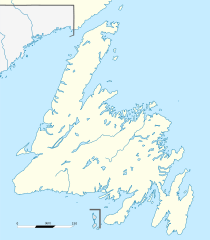
Description: Carte administrative de Terre-Neuve, Canada.
Title: Canada Newfoundland location map
Credit: Canada Newfoundland and Labrador relief location map.jpg
Author: NordNordWest (original map), Flappiefh (cropping, scale and graticules).
Usage Terms: Creative Commons Attribution-Share Alike 3.0
License: CC BY-SA 3.0
License Link: https://creativecommons.org/licenses/by-sa/3.0
Attribution Required?: Yes
Image usage
The following 46 pages link to this image:
- Abbott Cove
- Bay d'Espoir
- Bay of Exploits
- Bell Island (Newfoundland and Labrador)
- Belle Isle (Newfoundland and Labrador)
- Bonavista Bay
- Bottle Cove
- Brunette Island
- Bull Arm
- Cape Bauld
- Cape Bonavista
- Cape Freels
- Cape Spear
- Cape St. George, Newfoundland and Labrador
- Cape St. John
- Change Islands
- Codroy Valley
- Corner Brook
- Fort Point, Newfoundland and Labrador
- Fortune Bay
- Funk Island
- Gander Bay
- Glover Island
- Grand Codroy Estuary
- Great Colinet Island
- Green Bay, Newfoundland and Labrador
- Green Island (Fortune), Newfoundland and Labrador
- Gunners Pond
- Hermitage Bay
- Horse Islands
- List of historic places in the Bonavista Bay region
- List of historic places on the Avalon Peninsula
- Little Bay Islands
- Long Island (Hermitage Bay, Newfoundland)
- Long Island (Placentia Bay, Newfoundland and Labrador)
- Mount Pearl
- New World Island
- Pee Pee Island
- Placentia Bay
- Red Bay, Newfoundland and Labrador
- Smith Sound, Newfoundland and Labrador
- St. Mary's Bay, Newfoundland and Labrador
- Tilting, Newfoundland and Labrador
- Trinity Bay (Newfoundland and Labrador)
- Trump Islands (Newfoundland and Labrador)
- Twillingate Islands

All content from Kiddle encyclopedia articles (including the article images and facts) can be freely used under Attribution-ShareAlike license, unless stated otherwise.