
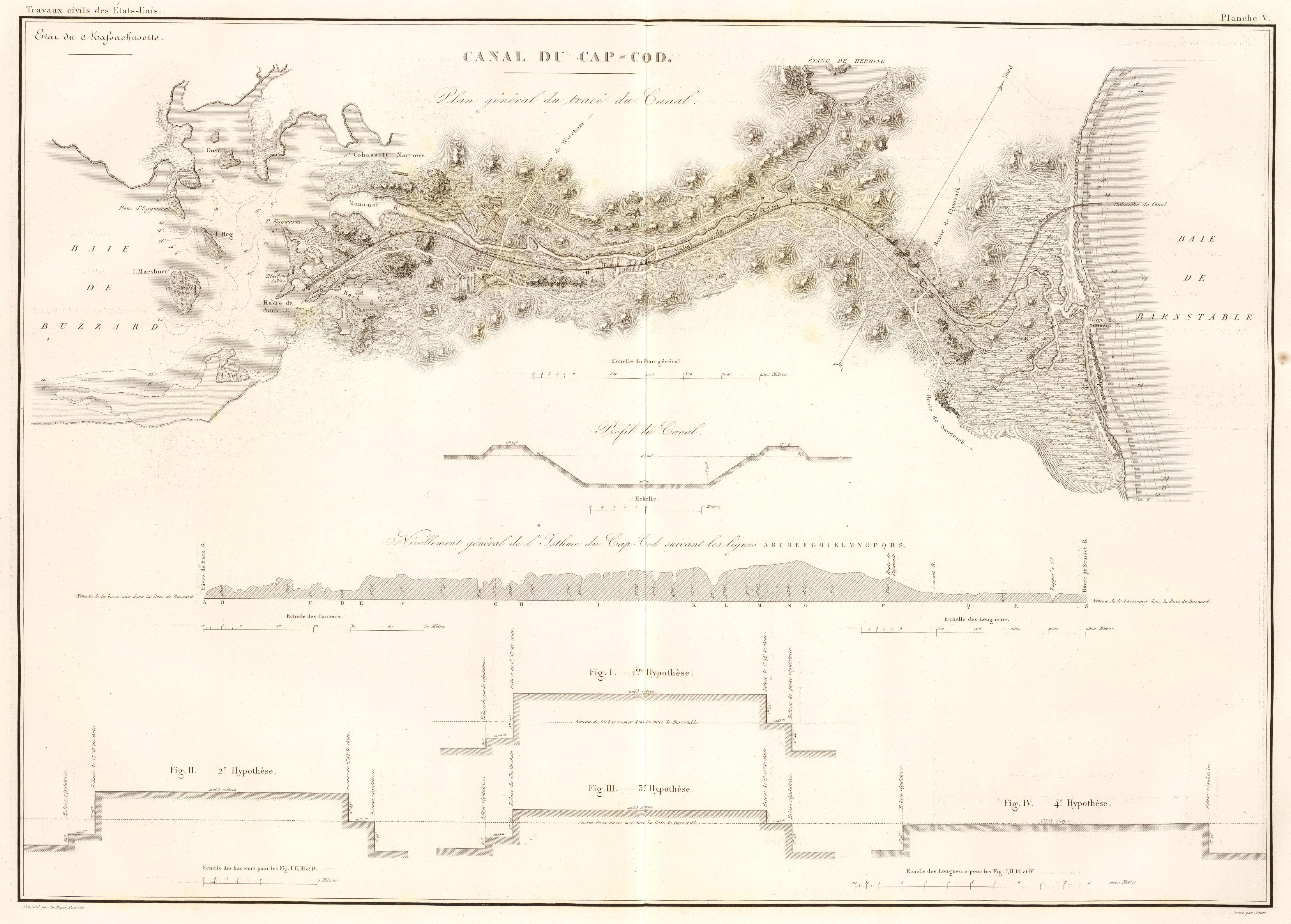
Image: Canal du Cap-Cod (Massachusetts), 1834 map
Description: Map of a proposed plan for a Cape Cod Canal, Massachusetts, USA; published 1834. Several such plans were drawn up circa 1830; none were built.
Title: Canal du Cap-Cod (Massachusetts), 1834 map
Credit: "Canal du Cap-Cod", in Travaux d'ameliorations interieures projetes ou executes par le Gouvernement General des Etats-Unis d'Amerique, de 1824 a 1831, by Guillaume Tell Poussin, Paris : Libraire Anselin, 1834. This image is from the David Rumsey Map Collection, and has been cropped and contrast-enhanced for clarity.
Author: Guillaume Tell Poussin
Permission: The following text is taken from the David Rumsey web site: Images copyright © 2000 by Cartography Associates. Images may be reproduced or transmitted, but not for commercial use. For commercial use or commercial republication, contact carto@luna-img.com. This work is licensed under a Creative Commons License.
Usage Terms: Public domain
License: Public domain
Attribution Required?: No
Image usage
The following page links to this image:

,_1834_map.jpg)